

Valmorel - Col de la Madeleine
A cycling route starting in Salins-les-Thermes, Auvergne-Rhône-Alpes, France.
Overview
About this route
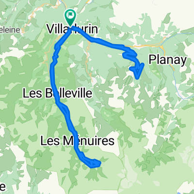
From Club Med in Valmorel to the Col the la Madeleine and back. Steep gravel tracks going up through the Ski resort, highest point some 200m above la Madeleine. Very steep descent on bad track to the Col.
- -:--
- Duration
- 23.8 km
- Distance
- 1,102 m
- Ascent
- 1,104 m
- Descent
- ---
- Avg. speed
- ---
- Max. altitude
Route quality
Waytypes & surfaces along the route
Waytypes
Track
19.9 km
(83 %)
Busy road
3.3 km
(14 %)
Surfaces
Paved
3.3 km
(14 %)
Unpaved
19.6 km
(82 %)
Ground
18.9 km
(79 %)
Asphalt
3.3 km
(14 %)
Continue with Bikemap
Use, edit, or download this cycling route
You would like to ride Valmorel - Col de la Madeleine or customize it for your own trip? Here is what you can do with this Bikemap route:
Free features
- Save this route as favorite or in collections
- Copy & plan your own version of this route
- Sync your route with Garmin or Wahoo
Premium features
Free trial for 3 days, or one-time payment. More about Bikemap Premium.
- Navigate this route on iOS & Android
- Export a GPX / KML file of this route
- Create your custom printout (try it for free)
- Download this route for offline navigation
Discover more Premium features.
Get Bikemap PremiumFrom our community
Other popular routes starting in Salins-les-Thermes
 Moutiers - Val Tho
- Distance
- 34.4 km
- Ascent
- 2,761 m
- Descent
- 959 m
- Location
- Salins-les-Thermes, Auvergne-Rhône-Alpes, France
 Moutiers-Courchevel
- Distance
- 19.9 km
- Ascent
- 1,228 m
- Descent
- 109 m
- Location
- Salins-les-Thermes, Auvergne-Rhône-Alpes, France
 test gpx garmin
- Distance
- 41.1 km
- Ascent
- 1,226 m
- Descent
- 1,225 m
- Location
- Salins-les-Thermes, Auvergne-Rhône-Alpes, France
 Le Bourg-d'Oisans - Valmorel
- Distance
- 215.4 km
- Ascent
- 5,249 m
- Descent
- 5,928 m
- Location
- Salins-les-Thermes, Auvergne-Rhône-Alpes, France
 MOUTIERS - COURCHEVEL - MOUTIERS - VAL THORENS - MOUTIERS
- Distance
- 105.6 km
- Ascent
- 3,042 m
- Descent
- 3,042 m
- Location
- Salins-les-Thermes, Auvergne-Rhône-Alpes, France
 loze 102km 3000NMV
- Distance
- 100 km
- Ascent
- 3,838 m
- Descent
- 3,842 m
- Location
- Salins-les-Thermes, Auvergne-Rhône-Alpes, France
 D 90 D, Salins-Fontaine à 138 Route de la Montagne, Sainte-Hélène-sur-Isère
- Distance
- 44.4 km
- Ascent
- 459 m
- Descent
- 760 m
- Location
- Salins-les-Thermes, Auvergne-Rhône-Alpes, France
 Valmorel - Col de la Madeleine
- Distance
- 23.8 km
- Ascent
- 1,102 m
- Descent
- 1,104 m
- Location
- Salins-les-Thermes, Auvergne-Rhône-Alpes, France
Open it in the app