- 154 km
- 952 m
- 952 m
- Carsac-Aillac, Nouvelle-Aquitaine, France
23-6-2015 Rondje rondom Sarlat la Caneda. (fr)
A cycling route starting in Carsac-Aillac, Nouvelle-Aquitaine, France.
Overview
About this route
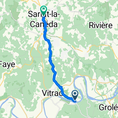
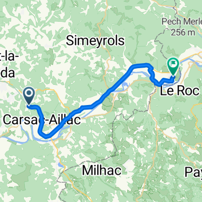
Rode a route starting from the camping La Bouysse in Caudon/Vitrac via a beautiful quiet country road to the Viaduct in Sarlat la Canéda, rode through Sarlat and took a steep climb on the north side towards Saint Nathalène. Then headed to Carlux and then again descended towards the river Dordogne, there picked up the Voie Verte again and returned to the camping via Calviac and Perigord and Carsac/Aillac through the Cingle de Montfort. Temperature 25 degrees, total elevation 495.
- -:--
- Duration
- 41.3 km
- Distance
- 440 m
- Ascent
- 437 m
- Descent
- ---
- Avg. speed
- ---
- Max. altitude
Route quality
Waytypes & surfaces along the route
Waytypes
Quiet road
12.8 km
(31 %)
Road
9.5 km
(23 %)
Surfaces
Paved
28.1 km
(68 %)
Unpaved
0.4 km
(1 %)
Asphalt
28.1 km
(68 %)
Ground
0.4 km
(1 %)
Undefined
12.8 km
(31 %)
Continue with Bikemap
Use, edit, or download this cycling route
You would like to ride 23-6-2015 Rondje rondom Sarlat la Caneda. (fr) or customize it for your own trip? Here is what you can do with this Bikemap route:
Free features
- Save this route as favorite or in collections
- Copy & plan your own version of this route
- Sync your route with Garmin or Wahoo
Premium features
Free trial for 3 days, or one-time payment. More about Bikemap Premium.
- Navigate this route on iOS & Android
- Export a GPX / KML file of this route
- Create your custom printout (try it for free)
- Download this route for offline navigation
Discover more Premium features.
Get Bikemap PremiumFrom our community
Other popular routes starting in Carsac-Aillac
- Boucle Périgord
- Itinéraire sportif en Beynac-et-Cazenac
- 19.1 km
- 261 m
- 224 m
- Carsac-Aillac, Nouvelle-Aquitaine, France
- la Sarladaise
- 118.3 km
- 986 m
- 984 m
- Carsac-Aillac, Nouvelle-Aquitaine, France
- R7F3+V6 naar Rue de la Calprenede
- 9.9 km
- 187 m
- 109 m
- Carsac-Aillac, Nouvelle-Aquitaine, France
- Etape 16 bis Groléjac / Montignac lascaux
- 40.1 km
- 841 m
- 718 m
- Carsac-Aillac, Nouvelle-Aquitaine, France
- 20-6-2015 (za) Rondje langs de Dordogne. (fr)
- 44.8 km
- 369 m
- 366 m
- Carsac-Aillac, Nouvelle-Aquitaine, France
- V91: Carsac-Aillac - Souillac
- 21.1 km
- 124 m
- 152 m
- Carsac-Aillac, Nouvelle-Aquitaine, France
- Kastelenroute vanaf Carsac-Aillac
- 37.5 km
- 673 m
- 667 m
- Carsac-Aillac, Nouvelle-Aquitaine, France
Open it in the app


