

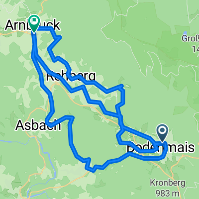
Riederin-Kuh-,Guts-und Märchenalm-Kothing-Riederin
A cycling route starting in Bodenmais, Bavaria, Germany.
Overview
About this route
TEASI Track
- -:--
- Duration
- 11.7 km
- Distance
- 394 m
- Ascent
- 406 m
- Descent
- ---
- Avg. speed
- ---
- Max. altitude
Continue with Bikemap
Use, edit, or download this cycling route
You would like to ride Riederin-Kuh-,Guts-und Märchenalm-Kothing-Riederin or customize it for your own trip? Here is what you can do with this Bikemap route:
Free features
- Save this route as favorite or in collections
- Copy & plan your own version of this route
- Sync your route with Garmin or Wahoo
Premium features
Free trial for 3 days, or one-time payment. More about Bikemap Premium.
- Navigate this route on iOS & Android
- Export a GPX / KML file of this route
- Create your custom printout (try it for free)
- Download this route for offline navigation
Discover more Premium features.
Get Bikemap PremiumFrom our community
Other popular routes starting in Bodenmais
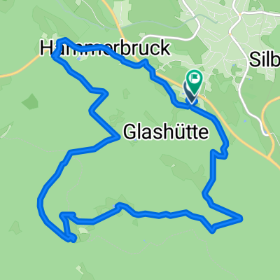
 Bo67_Bodenmaiser_Schtze
- Distance
- 12.5 km
- Ascent
- 427 m
- Descent
- 429 m
- Location
- Bodenmais, Bavaria, Germany
 Riederin-Kuh-,Guts-und Märchenalm-Kothing-Riederin
- Distance
- 11.7 km
- Ascent
- 394 m
- Descent
- 406 m
- Location
- Bodenmais, Bavaria, Germany
 Silberberg-Rundweg_Top
- Distance
- 4.8 km
- Ascent
- 192 m
- Descent
- 195 m
- Location
- Bodenmais, Bavaria, Germany
 Große Zellertal activ
- Distance
- 46.4 km
- Ascent
- 647 m
- Descent
- 741 m
- Location
- Bodenmais, Bavaria, Germany
 Bodenmais - Arbergipfel
- Distance
- 30 km
- Ascent
- 952 m
- Descent
- 952 m
- Location
- Bodenmais, Bavaria, Germany
 Bodenmai Kleiner Arbersee über Brettlschachen
- Distance
- 61.1 km
- Ascent
- 1,220 m
- Descent
- 1,415 m
- Location
- Bodenmais, Bavaria, Germany
 erste Wanderung Panoramastr.
- Distance
- 5.8 km
- Ascent
- 1,067 m
- Descent
- 369 m
- Location
- Bodenmais, Bavaria, Germany
 Bo50__Brandtner-Riegel-Runde
- Distance
- 6.4 km
- Ascent
- 274 m
- Descent
- 271 m
- Location
- Bodenmais, Bavaria, Germany
Open it in the app