

Alpes 1
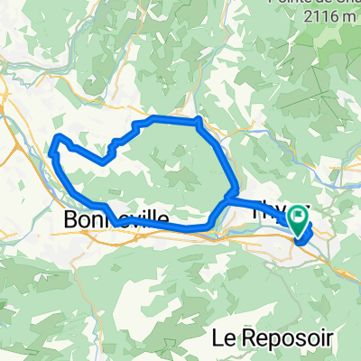
A cycling route starting in Scionzier, Auvergne-Rhône-Alpes, France.
Overview
About this route
July 2015
(cloned from route 2830514)- -:--
- Duration
- 103.8 km
- Distance
- 2,412 m
- Ascent
- 2,560 m
- Descent
- ---
- Avg. speed
- ---
- Max. altitude

Route quality
Waytypes & surfaces along the route
Waytypes
Quiet road
2.1 km
(2 %)
Undefined
101.8 km
(98 %)
Surfaces
Paved
96.6 km
(93 %)
Asphalt
96.6 km
(93 %)
Undefined
7.3 km
(7 %)
Continue with Bikemap
Use, edit, or download this cycling route
You would like to ride Alpes 1 or customize it for your own trip? Here is what you can do with this Bikemap route:
Free features
- Save this route as favorite or in collections
- Copy & plan your own version of this route
- Split it into stages to create a multi-day tour
- Sync your route with Garmin or Wahoo
Premium features
Free trial for 3 days, or one-time payment. More about Bikemap Premium.
- Navigate this route on iOS & Android
- Export a GPX / KML file of this route
- Create your custom printout (try it for free)
- Download this route for offline navigation
Discover more Premium features.
Get Bikemap PremiumFrom our community
Other popular routes starting in Scionzier
 Fra - day 2_3
- Distance
- 65.3 km
- Ascent
- 2,206 m
- Descent
- 1,223 m
- Location
- Scionzier, Auvergne-Rhône-Alpes, France
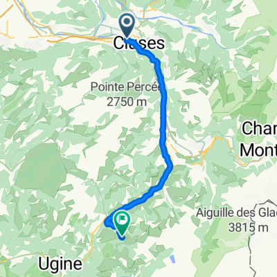
 Etape 2a - Route grands Alpes
- Distance
- 25.7 km
- Ascent
- 816 m
- Descent
- 709 m
- Location
- Scionzier, Auvergne-Rhône-Alpes, France
 Cluses J4 Cyclos
- Distance
- 48.9 km
- Ascent
- 459 m
- Descent
- 458 m
- Location
- Scionzier, Auvergne-Rhône-Alpes, France
 Fra - day 2_po dolini
- Distance
- 45.4 km
- Ascent
- 1,151 m
- Descent
- 168 m
- Location
- Scionzier, Auvergne-Rhône-Alpes, France
 Cluses J3 Cyclos
- Distance
- 107.3 km
- Ascent
- 1,191 m
- Descent
- 1,191 m
- Location
- Scionzier, Auvergne-Rhône-Alpes, France
 Alpes 1
- Distance
- 103.8 km
- Ascent
- 2,412 m
- Descent
- 2,560 m
- Location
- Scionzier, Auvergne-Rhône-Alpes, France
 Cluses J3 Sportifs
- Distance
- 127.2 km
- Ascent
- 2,347 m
- Descent
- 2,347 m
- Location
- Scionzier, Auvergne-Rhône-Alpes, France
 Col de Colombière both side and Col de Romme
- Distance
- 66.3 km
- Ascent
- 2,103 m
- Descent
- 2,107 m
- Location
- Scionzier, Auvergne-Rhône-Alpes, France
Open it in the app