

PBN Csapatépítő Tekerő 1. nap 2. rész
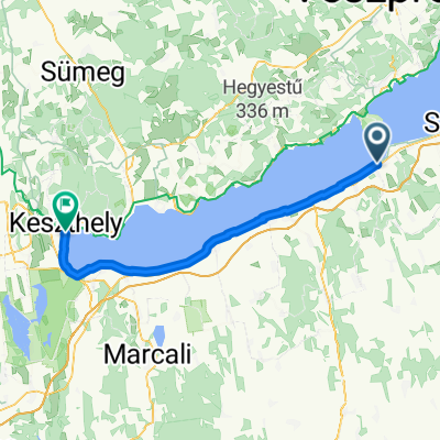
A cycling route starting in Balatonföldvár, Somogy County, Hungary.
Overview
About this route
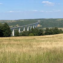
Balaton, délipart. Palacsintalapos. :) Kompozás után még egy kis terekés.
- -:--
- Duration
- 22.9 km
- Distance
- 40 m
- Ascent
- 34 m
- Descent
- ---
- Avg. speed
- ---
- Max. altitude

Route quality
Waytypes & surfaces along the route
Waytypes
Quiet road
11.9 km
(52 %)
Living street
6.7 km
(29 %)
Surfaces
Paved
21.9 km
(96 %)
Asphalt
21.6 km
(94 %)
Paving stones
0.2 km
(<1 %)
Continue with Bikemap
Use, edit, or download this cycling route
You would like to ride PBN Csapatépítő Tekerő 1. nap 2. rész or customize it for your own trip? Here is what you can do with this Bikemap route:
Free features
- Save this route as favorite or in collections
- Copy & plan your own version of this route
- Sync your route with Garmin or Wahoo
Premium features
Free trial for 3 days, or one-time payment. More about Bikemap Premium.
- Navigate this route on iOS & Android
- Export a GPX / KML file of this route
- Create your custom printout (try it for free)
- Download this route for offline navigation
Discover more Premium features.
Get Bikemap PremiumFrom our community
Other popular routes starting in Balatonföldvár
 Kőröshegyi tekergés
- Distance
- 37.2 km
- Ascent
- 540 m
- Descent
- 537 m
- Location
- Balatonföldvár, Somogy County, Hungary
 Vak Bottyán utca, Balatonföldvár - Helikonliget, Keszthely
- Distance
- 63 km
- Ascent
- 122 m
- Descent
- 124 m
- Location
- Balatonföldvár, Somogy County, Hungary
 Balaton félkör Keszthely felé
- Distance
- 143.7 km
- Ascent
- 150 m
- Descent
- 150 m
- Location
- Balatonföldvár, Somogy County, Hungary
 Széchenyi Imre utca - Somogyi Béla utca
- Distance
- 41.7 km
- Ascent
- 752 m
- Descent
- 754 m
- Location
- Balatonföldvár, Somogy County, Hungary
 Kőrös hegyi tekergés 2.
- Distance
- 42 km
- Ascent
- 614 m
- Descent
- 616 m
- Location
- Balatonföldvár, Somogy County, Hungary
 Balatoni kör 3 nap
- Distance
- 55.1 km
- Ascent
- 71 m
- Descent
- 64 m
- Location
- Balatonföldvár, Somogy County, Hungary
 Zrínyi utca 8, Szántód - Zrínyi utca 6, Szántód
- Distance
- 65.8 km
- Ascent
- 503 m
- Descent
- 455 m
- Location
- Balatonföldvár, Somogy County, Hungary
 Balatoni kör 2 nap
- Distance
- 82.6 km
- Ascent
- 163 m
- Descent
- 165 m
- Location
- Balatonföldvár, Somogy County, Hungary
Open it in the app