

Chata Ostry - Ropice - Hot. Ondrasz
A cycling route starting in Cieszyn, Silesian Voivodeship, Poland.
Overview
About this route
24.06.15 W&R
- -:--
- Duration
- 55.4 km
- Distance
- 989 m
- Ascent
- 989 m
- Descent
- ---
- Avg. speed
- ---
- Max. altitude

Route quality
Waytypes & surfaces along the route
Waytypes
Quiet road
14.4 km
(26 %)
Path
14.4 km
(26 %)
Surfaces
Paved
19.4 km
(35 %)
Unpaved
8.9 km
(16 %)
Asphalt
15.5 km
(28 %)
Gravel
5.5 km
(10 %)
Route highlights
Points of interest along the route

Photo after 0 km
Start: Restauracja Ogrodowa

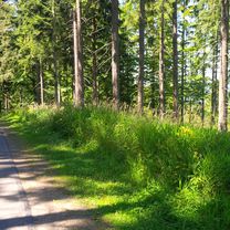
Photo after 14.4 km

Accommodation after 15.4 km
Chata Kozinec

Photo after 18.2 km

Point of interest after 18.2 km

Accommodation after 20.2 km
Chata Ostry

Point of interest after 20.2 km
Ostry

Photo after 20.3 km

Photo after 26.4 km
na szlaku

Photo after 27.2 km
Mała Fatra w oddali

Point of interest after 27.6 km
Ropice 1082 m

Photo after 29.1 km
Velky Lipovy - końcówka zjazdu

Photo after 29.1 km
przełęcz

Photo after 29.5 km
Continue with Bikemap
Use, edit, or download this cycling route
You would like to ride Chata Ostry - Ropice - Hot. Ondrasz or customize it for your own trip? Here is what you can do with this Bikemap route:
Free features
- Save this route as favorite or in collections
- Copy & plan your own version of this route
- Sync your route with Garmin or Wahoo
Premium features
Free trial for 3 days, or one-time payment. More about Bikemap Premium.
- Navigate this route on iOS & Android
- Export a GPX / KML file of this route
- Create your custom printout (try it for free)
- Download this route for offline navigation
Discover more Premium features.
Get Bikemap PremiumFrom our community
Other popular routes starting in Cieszyn
 W Dolomity (12 dni) 2002r
- Distance
- 2,273.5 km
- Ascent
- 34,645 m
- Descent
- 34,441 m
- Location
- Cieszyn, Silesian Voivodeship, Poland
 Białogród i słupy graniczne
- Distance
- 80.7 km
- Ascent
- 273 m
- Descent
- 273 m
- Location
- Cieszyn, Silesian Voivodeship, Poland
 Slovakia
- Distance
- 956.1 km
- Ascent
- 928 m
- Descent
- 1,082 m
- Location
- Cieszyn, Silesian Voivodeship, Poland
 Tour de Mała Fatra
- Distance
- 260.8 km
- Ascent
- 855 m
- Descent
- 846 m
- Location
- Cieszyn, Silesian Voivodeship, Poland
 Cieszyn-Dziegielow-Goleszow-Puncow-Cieszyn
- Distance
- 24.3 km
- Ascent
- 271 m
- Descent
- 276 m
- Location
- Cieszyn, Silesian Voivodeship, Poland
 Chata Ostry - Ropice - Hot. Ondrasz
- Distance
- 55.4 km
- Ascent
- 989 m
- Descent
- 989 m
- Location
- Cieszyn, Silesian Voivodeship, Poland
 Hrčava
- Distance
- 103.3 km
- Ascent
- 692 m
- Descent
- 691 m
- Location
- Cieszyn, Silesian Voivodeship, Poland
 Groniczek, Głowa konia, Filipka, Łączka
- Distance
- 58.8 km
- Ascent
- 772 m
- Descent
- 773 m
- Location
- Cieszyn, Silesian Voivodeship, Poland
Open it in the app