

Die sieben Odenwald-Schwestern
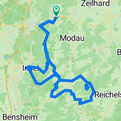
A cycling route starting in Ober-Ramstadt, Hesse, Germany.
Overview
About this route
This route was an attempt to accumulate as much elevation gain as possible over the shortest distance in the Odenwald, without having to ride the same sections multiple times. The name of the route comes from the seven climbs that it contains. The two longest and most strenuous are the Neunkirchen height, which is ridden up to the radar station, and the Melibocus.
A note: The elevation profile is not accurate, in total, this route comes very close to 2000 meters of elevation, which breaks down as follows:
Mühltal - p.400: 250hm Beedenkirchen - Brandau: 50hm Brandau - Radarturm: 300hm Reichenbach - Kuralpe: 300hm (two small counter-climbs) Zwingenberg - Melibocus: 400hm Seeheim - Stettbach: 250hm Seeheim - Frankenstein: 250hm Frankenstein - Mühltal: 50hm
If you ride back from Melibocus via Balkhausen and from Neunkirchen via Winterkasten to Reichenbach, you would actually accumulate well over 2000m of elevation over about 90 km!
- -:--
- Duration
- 90.4 km
- Distance
- 1,540 m
- Ascent
- 1,547 m
- Descent
- ---
- Avg. speed
- ---
- Max. altitude
Route highlights
Points of interest along the route
Point of interest after 19.6 km
Neunkirchner Höhe Radarstation, 603m
Point of interest after 50.1 km
Melibocus, 517m
Continue with Bikemap
Use, edit, or download this cycling route
You would like to ride Die sieben Odenwald-Schwestern or customize it for your own trip? Here is what you can do with this Bikemap route:
Free features
- Save this route as favorite or in collections
- Copy & plan your own version of this route
- Split it into stages to create a multi-day tour
- Sync your route with Garmin or Wahoo
Premium features
Free trial for 3 days, or one-time payment. More about Bikemap Premium.
- Navigate this route on iOS & Android
- Export a GPX / KML file of this route
- Create your custom printout (try it for free)
- Download this route for offline navigation
Discover more Premium features.
Get Bikemap PremiumFrom our community
Other popular routes starting in Ober-Ramstadt
 Rennradtour
- Distance
- 64.2 km
- Ascent
- 324 m
- Descent
- 324 m
- Location
- Ober-Ramstadt, Hesse, Germany
 Die sieben Odenwald-Schwestern
- Distance
- 90.4 km
- Ascent
- 1,540 m
- Descent
- 1,547 m
- Location
- Ober-Ramstadt, Hesse, Germany
 Rundkurs Modau - Groß-Bieberau - Reinheim
- Distance
- 22.6 km
- Ascent
- 261 m
- Descent
- 261 m
- Location
- Ober-Ramstadt, Hesse, Germany
 Lichtenberger Schloss
- Distance
- 29.5 km
- Ascent
- 301 m
- Descent
- 289 m
- Location
- Ober-Ramstadt, Hesse, Germany
 Gimme Five!
- Distance
- 65.2 km
- Ascent
- 1,059 m
- Descent
- 1,059 m
- Location
- Ober-Ramstadt, Hesse, Germany
 BT Burgruine Rodenstein
- Distance
- 37 km
- Ascent
- 482 m
- Descent
- 482 m
- Location
- Ober-Ramstadt, Hesse, Germany
 Burg Frankenstein
- Distance
- 39.8 km
- Ascent
- 531 m
- Descent
- 531 m
- Location
- Ober-Ramstadt, Hesse, Germany
 Fränkisch-Crumbach
- Distance
- 51.8 km
- Ascent
- 722 m
- Descent
- 721 m
- Location
- Ober-Ramstadt, Hesse, Germany
Open it in the app