

Round Hakodake & Piyashiri
A cycling route starting in Nayoro, Hokkaido, Japan.
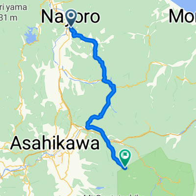
Overview
About this route
A ride around the two largest mountains in Northern Hokkaido
- -:--
- Duration
- 185.2 km
- Distance
- 1,009 m
- Ascent
- 1,007 m
- Descent
- ---
- Avg. speed
- ---
- Max. altitude

Continue with Bikemap
Use, edit, or download this cycling route
You would like to ride Round Hakodake & Piyashiri or customize it for your own trip? Here is what you can do with this Bikemap route:
Free features
- Save this route as favorite or in collections
- Copy & plan your own version of this route
- Split it into stages to create a multi-day tour
- Sync your route with Garmin or Wahoo
Premium features
Free trial for 3 days, or one-time payment. More about Bikemap Premium.
- Navigate this route on iOS & Android
- Export a GPX / KML file of this route
- Create your custom printout (try it for free)
- Download this route for offline navigation
Discover more Premium features.
Get Bikemap PremiumFrom our community
Other popular routes starting in Nayoro
 名寄センチュリー・Nayoro Century Course
- Distance
- 160.8 km
- Ascent
- 1,331 m
- Descent
- 1,331 m
- Location
- Nayoro, Hokkaido, Japan
 Nayoro Century Half-course
- Distance
- 74.2 km
- Ascent
- 344 m
- Descent
- 349 m
- Location
- Nayoro, Hokkaido, Japan
 名寄周回コース2(朱鞠内)
- Distance
- 53 km
- Ascent
- 647 m
- Descent
- 645 m
- Location
- Nayoro, Hokkaido, Japan
 名寄周回コース3(和寒)
- Distance
- 93.3 km
- Ascent
- 134 m
- Descent
- 134 m
- Location
- Nayoro, Hokkaido, Japan
 One Stoplight
- Distance
- 113.1 km
- Ascent
- 1,417 m
- Descent
- 497 m
- Location
- Nayoro, Hokkaido, Japan
 名寄周回コース1(風連)
- Distance
- 23 km
- Ascent
- 79 m
- Descent
- 80 m
- Location
- Nayoro, Hokkaido, Japan
 Round Hakodake & Piyashiri
- Distance
- 185.2 km
- Ascent
- 1,009 m
- Descent
- 1,007 m
- Location
- Nayoro, Hokkaido, Japan
 Nayoro Century 2015
- Distance
- 146.3 km
- Ascent
- 1,352 m
- Descent
- 1,352 m
- Location
- Nayoro, Hokkaido, Japan
Open it in the app