

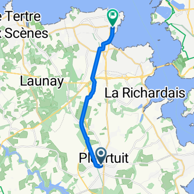
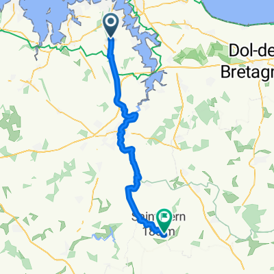
St Malo - Les Conches (Vendee)
A cycling route starting in Pleurtuit, Brittany Region, France.
Overview
About this route
Planing for August 2015, Cycling Family Trip
no clue about practicality of this road yet. will the trailers go through? how hilly is it? is it paved? Gravelled? sand? swamps?- -:--
- Duration
- 388.7 km
- Distance
- 386 m
- Ascent
- 429 m
- Descent
- ---
- Avg. speed
- ---
- Max. altitude
Route quality
Waytypes & surfaces along the route
Waytypes
Quiet road
111.7 km
(29 %)
Cycleway
98.2 km
(25 %)
Surfaces
Paved
168.1 km
(43 %)
Unpaved
74.3 km
(19 %)
Asphalt
164 km
(42 %)
Gravel
43.4 km
(11 %)
Continue with Bikemap
Use, edit, or download this cycling route
You would like to ride St Malo - Les Conches (Vendee) or customize it for your own trip? Here is what you can do with this Bikemap route:
Free features
- Save this route as favorite or in collections
- Copy & plan your own version of this route
- Split it into stages to create a multi-day tour
- Sync your route with Garmin or Wahoo
Premium features
Free trial for 3 days, or one-time payment. More about Bikemap Premium.
- Navigate this route on iOS & Android
- Export a GPX / KML file of this route
- Create your custom printout (try it for free)
- Download this route for offline navigation
Discover more Premium features.
Get Bikemap PremiumFrom our community
Other popular routes starting in Pleurtuit
 Rue de Dinan, Pleurtuit à Rue Henri Maulion, Dinard
- Distance
- 7.3 km
- Ascent
- 11 m
- Descent
- 58 m
- Location
- Pleurtuit, Brittany Region, France
 St Malo - Les Conches (Vendee)
- Distance
- 388.7 km
- Ascent
- 386 m
- Descent
- 429 m
- Location
- Pleurtuit, Brittany Region, France
 Le Minihic
- Distance
- 4.4 km
- Ascent
- 24 m
- Descent
- 55 m
- Location
- Pleurtuit, Brittany Region, France
 SEM 2015
- Distance
- 21.5 km
- Ascent
- 165 m
- Descent
- 165 m
- Location
- Pleurtuit, Brittany Region, France
 parcours PLOUGRESCANT
- Distance
- 139.6 km
- Ascent
- 610 m
- Descent
- 622 m
- Location
- Pleurtuit, Brittany Region, France
 De Rue de l'Aéroport 28, Pleurtuit à La Croix Flessier, Longaulnay
- Distance
- 43.9 km
- Ascent
- 740 m
- Descent
- 686 m
- Location
- Pleurtuit, Brittany Region, France
 De Rue Elise de Roche 3, Pleurtuit à Rue des Grippais 12, Saint-Samson-sur-Rance
- Distance
- 13.2 km
- Ascent
- 82 m
- Descent
- 97 m
- Location
- Pleurtuit, Brittany Region, France
 Pleurtuit - Roscoff 1
- Distance
- 221.6 km
- Ascent
- 835 m
- Descent
- 896 m
- Location
- Pleurtuit, Brittany Region, France
Open it in the app