

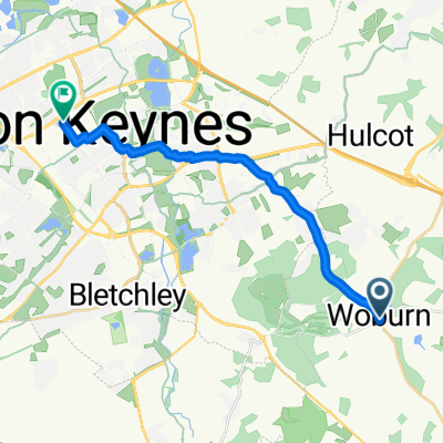
Woburn to Olney
A cycling route starting in Woburn, England, United Kingdom.
Overview
About this route
A Sunday ride.
(cloned from route 3113542)- -:--
- Duration
- 61.1 km
- Distance
- 320 m
- Ascent
- 320 m
- Descent
- ---
- Avg. speed
- ---
- Avg. speed

Continue with Bikemap
Use, edit, or download this cycling route
You would like to ride Woburn to Olney or customize it for your own trip? Here is what you can do with this Bikemap route:
Free features
- Save this route as favorite or in collections
- Copy & plan your own version of this route
- Sync your route with Garmin or Wahoo
Premium features
Free trial for 3 days, or one-time payment. More about Bikemap Premium.
- Navigate this route on iOS & Android
- Export a GPX / KML file of this route
- Create your custom printout (try it for free)
- Download this route for offline navigation
Discover more Premium features.
Get Bikemap PremiumFrom our community
Other popular routes starting in Woburn
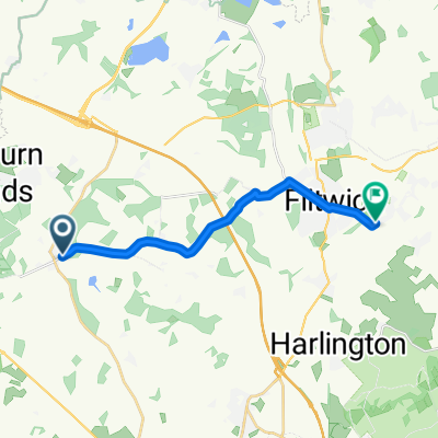 Park Street 5, Woburn to High Street 21, Greenfield
- Distance
- 11.4 km
- Ascent
- 102 m
- Descent
- 156 m
- Location
- Woburn, England, United Kingdom
 Woburn to Olney
- Distance
- 61.1 km
- Ascent
- 320 m
- Descent
- 320 m
- Location
- Woburn, England, United Kingdom
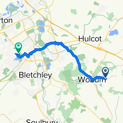 Woburn Park, Eversholt, Milton Keynes to H7 Chaffron Way, Knowlhill, Milton Keynes
- Distance
- 17 km
- Ascent
- 124 m
- Descent
- 175 m
- Location
- Woburn, England, United Kingdom
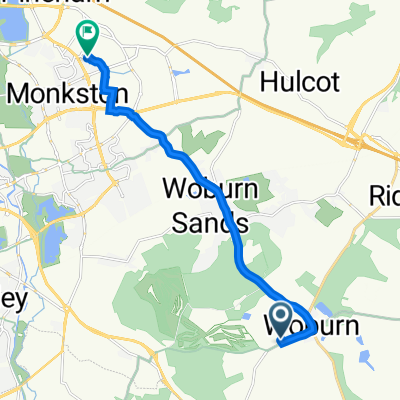 7 Maryland, Milton Keynes to 9 Bulmer Close, Milton Keynes
- Distance
- 9.8 km
- Ascent
- 60 m
- Descent
- 122 m
- Location
- Woburn, England, United Kingdom
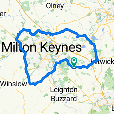 Milton Keynes Loop from Woburn
- Distance
- 80.8 km
- Ascent
- 382 m
- Descent
- 382 m
- Location
- Woburn, England, United Kingdom
 Milton Keynes Loop from Woburn
- Distance
- 80.8 km
- Ascent
- 382 m
- Descent
- 382 m
- Location
- Woburn, England, United Kingdom
 47 High Street, Milton Keynes to 501 Silbury Boulevard, Milton Keynes
- Distance
- 14 km
- Ascent
- 96 m
- Descent
- 102 m
- Location
- Woburn, England, United Kingdom
Open it in the app