

Tour Forêt Noire - Baiersbronn
A cycling route starting in Hœrdt, Grand Est, France.
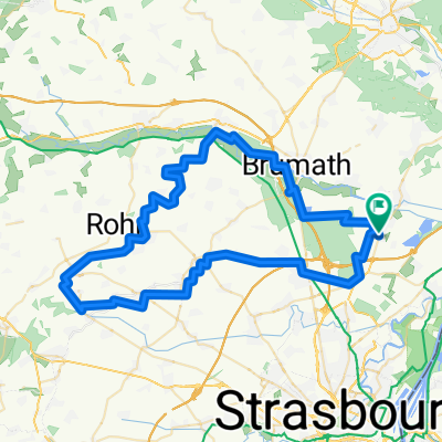
Overview
About this route
Black Forest Ride
- -:--
- Duration
- 97.9 km
- Distance
- 1,330 m
- Ascent
- 552 m
- Descent
- ---
- Avg. speed
- ---
- Max. altitude
Route quality
Waytypes & surfaces along the route
Waytypes
Road
20.6 km
(21 %)
Quiet road
7.8 km
(8 %)
Surfaces
Paved
87.1 km
(89 %)
Asphalt
86.1 km
(88 %)
Paved (undefined)
1 km
(1 %)
Undefined
10.8 km
(11 %)
Continue with Bikemap
Use, edit, or download this cycling route
You would like to ride Tour Forêt Noire - Baiersbronn or customize it for your own trip? Here is what you can do with this Bikemap route:
Free features
- Save this route as favorite or in collections
- Copy & plan your own version of this route
- Split it into stages to create a multi-day tour
- Sync your route with Garmin or Wahoo
Premium features
Free trial for 3 days, or one-time payment. More about Bikemap Premium.
- Navigate this route on iOS & Android
- Export a GPX / KML file of this route
- Create your custom printout (try it for free)
- Download this route for offline navigation
Discover more Premium features.
Get Bikemap PremiumFrom our community
Other popular routes starting in Hœrdt
 Kochersberg 75-88
- Distance
- 90.3 km
- Ascent
- 428 m
- Descent
- 430 m
- Location
- Hœrdt, Grand Est, France
 Kuttolsheim Waltenheim
- Distance
- 71.1 km
- Ascent
- 439 m
- Descent
- 440 m
- Location
- Hœrdt, Grand Est, France
 velo 23/07
- Distance
- 84.5 km
- Ascent
- 400 m
- Descent
- 401 m
- Location
- Hœrdt, Grand Est, France
 Westhoffen
- Distance
- 92.7 km
- Ascent
- 738 m
- Descent
- 738 m
- Location
- Hœrdt, Grand Est, France
 Westhoffen Wasselonne
- Distance
- 73.8 km
- Ascent
- 363 m
- Descent
- 363 m
- Location
- Hœrdt, Grand Est, France
 Tour Forêt Noire - Baiersbronn
- Distance
- 97.9 km
- Ascent
- 1,330 m
- Descent
- 552 m
- Location
- Hœrdt, Grand Est, France
 Raid
Raid- Distance
- 675.9 km
- Ascent
- 493 m
- Descent
- 626 m
- Location
- Hœrdt, Grand Est, France
 velo 23/07
- Distance
- 97.7 km
- Ascent
- 517 m
- Descent
- 518 m
- Location
- Hœrdt, Grand Est, France
Open it in the app