

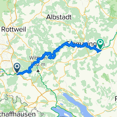
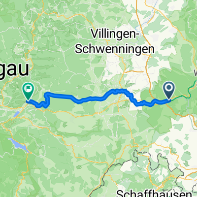
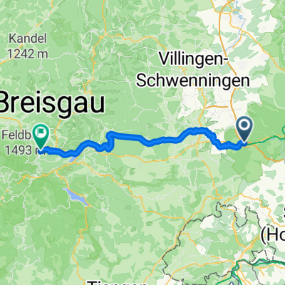
Geisingen nach Blumber Zollhaus (Sauschwänzlebahn)
A cycling route starting in Geisingen, Baden-Wurttemberg, Germany.
Overview
About this route
On mostly paved paths through the Aitrach valley
- -:--
- Duration
- 17.3 km
- Distance
- 167 m
- Ascent
- 132 m
- Descent
- ---
- Avg. speed
- 720 m
- Max. altitude
Route quality
Waytypes & surfaces along the route
Waytypes
Track
8.5 km
(49 %)
Access road
4.8 km
(28 %)
Surfaces
Paved
11.2 km
(65 %)
Unpaved
5.7 km
(33 %)
Asphalt
10 km
(58 %)
Gravel
2.2 km
(13 %)
Continue with Bikemap
Use, edit, or download this cycling route
You would like to ride Geisingen nach Blumber Zollhaus (Sauschwänzlebahn) or customize it for your own trip? Here is what you can do with this Bikemap route:
Free features
- Save this route as favorite or in collections
- Copy & plan your own version of this route
- Sync your route with Garmin or Wahoo
Premium features
Free trial for 3 days, or one-time payment. More about Bikemap Premium.
- Navigate this route on iOS & Android
- Export a GPX / KML file of this route
- Create your custom printout (try it for free)
- Download this route for offline navigation
Discover more Premium features.
Get Bikemap PremiumFrom our community
Other popular routes starting in Geisingen
 Geisingen-Mengen
- Distance
- 89 km
- Ascent
- 982 m
- Descent
- 1,089 m
- Location
- Geisingen, Baden-Wurttemberg, Germany
 Geisingen- Donaueschingen - Geisingen
- Distance
- 34.1 km
- Ascent
- 46 m
- Descent
- 49 m
- Location
- Geisingen, Baden-Wurttemberg, Germany
 Geislngen - Konstanz (busparkeerterrein)
- Distance
- 71.8 km
- Ascent
- 539 m
- Descent
- 811 m
- Location
- Geisingen, Baden-Wurttemberg, Germany
 Geisingen - Titisee-Neustadt
- Distance
- 50.5 km
- Ascent
- 691 m
- Descent
- 524 m
- Location
- Geisingen, Baden-Wurttemberg, Germany
 Bachweg 9, Bad Dürrheim nach Bachweg 12, Bad Dürrheim
- Distance
- 35.5 km
- Ascent
- 170 m
- Descent
- 119 m
- Location
- Geisingen, Baden-Wurttemberg, Germany
 Geisingen nach Blumber Zollhaus (Sauschwänzlebahn)
- Distance
- 17.3 km
- Ascent
- 167 m
- Descent
- 132 m
- Location
- Geisingen, Baden-Wurttemberg, Germany
 Tour 6 = Geisingen - Hinterzarten
- Distance
- 60.1 km
- Ascent
- 1,078 m
- Descent
- 706 m
- Location
- Geisingen, Baden-Wurttemberg, Germany
 Rund um den Wartenberg
- Distance
- 12.4 km
- Ascent
- 104 m
- Descent
- 104 m
- Location
- Geisingen, Baden-Wurttemberg, Germany
Open it in the app