

Flandern Rundfahrt
A cycling route starting in Frankenthal, Saxony, Germany.
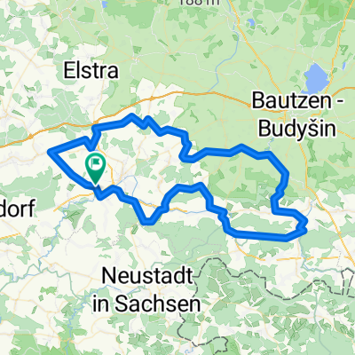
Overview
About this route
Something for everyone. Steep climbs, rough cobblestones and asphalt. A river crossing with a ferry. If you first row across with the ferry to Konstappel, you can ride to Klipphausen using the Stoppomat. So to speak, a cliché confirmer. Have fun. ULF (cloned from route 293413)
- -:--
- Duration
- 128.8 km
- Distance
- 663 m
- Ascent
- 664 m
- Descent
- ---
- Avg. speed
- ---
- Max. altitude
Route quality
Waytypes & surfaces along the route
Waytypes
Road
49 km
(38 %)
Quiet road
24.5 km
(19 %)
Surfaces
Paved
105.6 km
(82 %)
Unpaved
3.9 km
(3 %)
Asphalt
105.6 km
(82 %)
Unpaved (undefined)
1.3 km
(1 %)
Continue with Bikemap
Use, edit, or download this cycling route
You would like to ride Flandern Rundfahrt or customize it for your own trip? Here is what you can do with this Bikemap route:
Free features
- Save this route as favorite or in collections
- Copy & plan your own version of this route
- Split it into stages to create a multi-day tour
- Sync your route with Garmin or Wahoo
Premium features
Free trial for 3 days, or one-time payment. More about Bikemap Premium.
- Navigate this route on iOS & Android
- Export a GPX / KML file of this route
- Create your custom printout (try it for free)
- Download this route for offline navigation
Discover more Premium features.
Get Bikemap PremiumFrom our community
Other popular routes starting in Frankenthal
 Goldbach-Luchsenburg-Ohorn-Masenei
- Distance
- 34.3 km
- Ascent
- 242 m
- Descent
- 242 m
- Location
- Frankenthal, Saxony, Germany
 Lausnitzer Heide
- Distance
- 101.9 km
- Ascent
- 446 m
- Descent
- 446 m
- Location
- Frankenthal, Saxony, Germany
 Bischofswerda - Massenei Rundtour
- Distance
- 36.5 km
- Ascent
- 269 m
- Descent
- 271 m
- Location
- Frankenthal, Saxony, Germany
 10-07-13
- Distance
- 79.8 km
- Ascent
- 722 m
- Descent
- 722 m
- Location
- Frankenthal, Saxony, Germany
 Flandern Rundfahrt
- Distance
- 128.8 km
- Ascent
- 663 m
- Descent
- 664 m
- Location
- Frankenthal, Saxony, Germany
 MTB-Tour ab Dani
- Distance
- 54.1 km
- Ascent
- 478 m
- Descent
- 478 m
- Location
- Frankenthal, Saxony, Germany
 LKT-V2
- Distance
- 271.5 km
- Ascent
- 1,635 m
- Descent
- 1,636 m
- Location
- Frankenthal, Saxony, Germany
 Goldbach-Rammenau-Masenei Trainingsrunde
- Distance
- 29.8 km
- Ascent
- 189 m
- Descent
- 210 m
- Location
- Frankenthal, Saxony, Germany
Open it in the app