

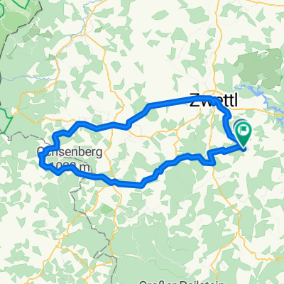
Zwettl - Kamprunde
A cycling route starting in Waldhausen, Lower Austria, Austria.
Overview
About this route
Sprögnitz - Zwettl - Schloß Rosenau - Etzen - Wiesensfeld - Rapottenstein - Sprögnitz
- -:--
- Duration
- 55.8 km
- Distance
- 667 m
- Ascent
- 660 m
- Descent
- ---
- Avg. speed
- ---
- Max. altitude
Route quality
Waytypes & surfaces along the route
Waytypes
Road
25.1 km
(45 %)
Quiet road
8.9 km
(16 %)
Surfaces
Paved
19 km
(34 %)
Asphalt
19 km
(34 %)
Undefined
36.8 km
(66 %)
Continue with Bikemap
Use, edit, or download this cycling route
You would like to ride Zwettl - Kamprunde or customize it for your own trip? Here is what you can do with this Bikemap route:
Free features
- Save this route as favorite or in collections
- Copy & plan your own version of this route
- Sync your route with Garmin or Wahoo
Premium features
Free trial for 3 days, or one-time payment. More about Bikemap Premium.
- Navigate this route on iOS & Android
- Export a GPX / KML file of this route
- Create your custom printout (try it for free)
- Download this route for offline navigation
Discover more Premium features.
Get Bikemap PremiumFrom our community
Other popular routes starting in Waldhausen
 Kl.Weißenb.-Brand-Monikolz-Voitsschl.
- Distance
- 28.6 km
- Ascent
- 342 m
- Descent
- 342 m
- Location
- Waldhausen, Lower Austria, Austria
 Bis Freiland
- Distance
- 98.7 km
- Ascent
- 502 m
- Descent
- 804 m
- Location
- Waldhausen, Lower Austria, Austria
 Tour 1
- Distance
- 88.8 km
- Ascent
- 931 m
- Descent
- 939 m
- Location
- Waldhausen, Lower Austria, Austria
 Route 1
- Distance
- 87.1 km
- Ascent
- 907 m
- Descent
- 908 m
- Location
- Waldhausen, Lower Austria, Austria
 Kremstalrunde
- Distance
- 54.9 km
- Ascent
- 681 m
- Descent
- 687 m
- Location
- Waldhausen, Lower Austria, Austria
 Zwettl - Kamprunde
- Distance
- 55.8 km
- Ascent
- 667 m
- Descent
- 660 m
- Location
- Waldhausen, Lower Austria, Austria
 Kleinw.-Schafb.-Roiten-Kleinw.
- Distance
- 25 km
- Ascent
- 375 m
- Descent
- 373 m
- Location
- Waldhausen, Lower Austria, Austria
 Rundtour nach Ottenschlag über Sallingberg
- Distance
- 46.4 km
- Ascent
- 464 m
- Descent
- 464 m
- Location
- Waldhausen, Lower Austria, Austria
Open it in the app