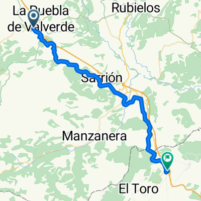
- 27.8 km
- 963 m
- 962 m
- Camarena de la Sierra, Aragon, Spain
PueblaValverde-Javalambre-Libros-Javalambre
A cycling route starting in Camarena de la Sierra, Aragon, Spain.
Overview
About this route
High-altitude stage. All kilometers are ridden above 800 meters elevation and 35 of them climb above 1500 meters. The climbs are very long and you will not forget passing through Riodeva—though knowing what awaits you now will make it easier. Great scenery and landscapes to enjoy. If you need to 'cut it short' you can skip the second ascent of Javalambre and go directly to Puebla de Valverde, which will save you 17 km and 400 meters of climbing.
More details at www.delfinpascual.com
- -:--
- Duration
- 124.4 km
- Distance
- 1,926 m
- Ascent
- 1,929 m
- Descent
- ---
- Avg. speed
- ---
- Max. altitude
Route quality
Waytypes & surfaces along the route
Waytypes
Road
68.4 km
(55 %)
Cycleway
13.7 km
(11 %)
Surfaces
Paved
21.1 km
(17 %)
Unpaved
1.2 km
(1 %)
Asphalt
21.1 km
(17 %)
Gravel
1.2 km
(1 %)
Undefined
102 km
(82 %)
Continue with Bikemap
Use, edit, or download this cycling route
You would like to ride PueblaValverde-Javalambre-Libros-Javalambre or customize it for your own trip? Here is what you can do with this Bikemap route:
Free features
- Save this route as favorite or in collections
- Copy & plan your own version of this route
- Split it into stages to create a multi-day tour
- Sync your route with Garmin or Wahoo
Premium features
Free trial for 3 days, or one-time payment. More about Bikemap Premium.
- Navigate this route on iOS & Android
- Export a GPX / KML file of this route
- Create your custom printout (try it for free)
- Download this route for offline navigation
Discover more Premium features.
Get Bikemap PremiumFrom our community
Other popular routes starting in Camarena de la Sierra
- Hacia rutas salvajes
- Et2 Puebla V. - Caudiel
- 64.1 km
- 518 m
- 1,044 m
- Camarena de la Sierra, Aragon, Spain
- Buscando la ruta perfecta
- 134 km
- 1,083 m
- 2,229 m
- Camarena de la Sierra, Aragon, Spain
- Spanje dag 3
- 90.2 km
- 1,281 m
- 1,098 m
- Camarena de la Sierra, Aragon, Spain
- Refugio_Rabada_Navarro-Arcos_Salinas
- 35.9 km
- 549 m
- 1,011 m
- Camarena de la Sierra, Aragon, Spain
- matahombres corta
- 38.9 km
- 933 m
- 933 m
- Camarena de la Sierra, Aragon, Spain
- De Estación de la Puebla de Valverde a Avenida Estación
- 44.9 km
- 189 m
- 422 m
- Camarena de la Sierra, Aragon, Spain
- ESP 032: Via Verde Ojos Negros (Südabschnitt- 1. Teil)
- 87.2 km
- 1,247 m
- 1,247 m
- Camarena de la Sierra, Aragon, Spain
Open it in the app


