

Hinterland
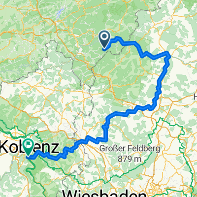
Feudingen-Caldern-Marburg und zurück
A cycling route starting in Erndtebrück, North Rhine-Westphalia, Germany.
Overview
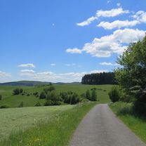
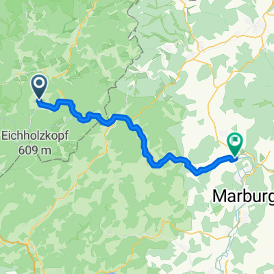
About this route
Lahntalradweg with shortcut from Caldern
- -:--
- Duration
- 100.3 km
- Distance
- 429 m
- Ascent
- 437 m
- Descent
- ---
- Avg. speed
- ---
- Max. altitude

Part of
Hinterland
12 stages
Route quality
Waytypes & surfaces along the route
Waytypes
Quiet road
37.1 km
(37 %)
Track
19.1 km
(19 %)
Surfaces
Paved
77.2 km
(77 %)
Unpaved
1 km
(1 %)
Asphalt
74.2 km
(74 %)
Paved (undefined)
3 km
(3 %)
Continue with Bikemap
Use, edit, or download this cycling route
You would like to ride Feudingen-Caldern-Marburg und zurück or customize it for your own trip? Here is what you can do with this Bikemap route:
Free features
- Save this route as favorite or in collections
- Copy & plan your own version of this route
- Split it into stages to create a multi-day tour
- Sync your route with Garmin or Wahoo
Premium features
Free trial for 3 days, or one-time payment. More about Bikemap Premium.
- Navigate this route on iOS & Android
- Export a GPX / KML file of this route
- Create your custom printout (try it for free)
- Download this route for offline navigation
Discover more Premium features.
Get Bikemap PremiumFrom our community
Other popular routes starting in Erndtebrück
 Edertal-Hinterland-Lahntal-Banfetal
- Distance
- 101.9 km
- Ascent
- 855 m
- Descent
- 854 m
- Location
- Erndtebrück, North Rhine-Westphalia, Germany
 lahntal feudingen-koblenz
- Distance
- 250.8 km
- Ascent
- 2,199 m
- Descent
- 2,514 m
- Location
- Erndtebrück, North Rhine-Westphalia, Germany
 Lahntal-Radweg
- Distance
- 245.8 km
- Ascent
- 235 m
- Descent
- 781 m
- Location
- Erndtebrück, North Rhine-Westphalia, Germany
 LahnRadWeg-Quelle-MR
- Distance
- 69 km
- Ascent
- 142 m
- Descent
- 568 m
- Location
- Erndtebrück, North Rhine-Westphalia, Germany
 Lahnradweg ca. 268 km, Gesamttour
- Distance
- 267.2 km
- Ascent
- 1,936 m
- Descent
- 2,476 m
- Location
- Erndtebrück, North Rhine-Westphalia, Germany
 Von Bad Laasphe bis Lahntal
- Distance
- 29.6 km
- Ascent
- 426 m
- Descent
- 678 m
- Location
- Erndtebrück, North Rhine-Westphalia, Germany
 erndtebrück zinse röspe erndtebrück
- Distance
- 11.3 km
- Ascent
- 135 m
- Descent
- 194 m
- Location
- Erndtebrück, North Rhine-Westphalia, Germany
 Vom Ilsetal über Hesselbach ins Hinterland und über den Ederradweg zurück zum Ilsetal
- Distance
- 124.3 km
- Ascent
- 921 m
- Descent
- 924 m
- Location
- Erndtebrück, North Rhine-Westphalia, Germany
Open it in the app