

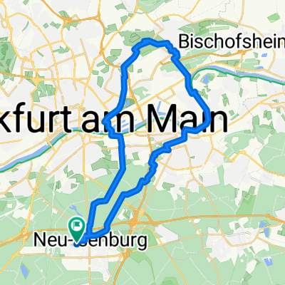
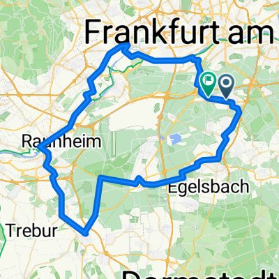
Isenburger Runde
A cycling route starting in Neu-Isenburg, Hesse, Germany.
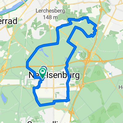
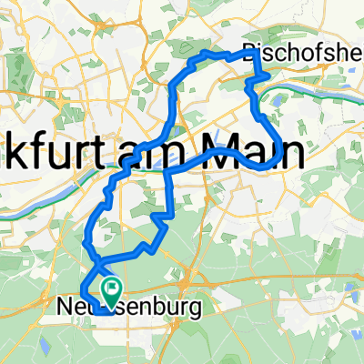
Overview
About this route
McDonalds Neu-Isenburg, Neuhof Golfplatz, Götzenhain, Offenthal, Urberach, Epperthausen, Münster, Altheim, Richen, Kleestadt. Langstadt, Babenhausen, Niederrode/Dudenhofen, Dietzenbach, (Gwerbegebiet Nord), (evtl. Paterhöuser Hof enkehren) Heusenstamm, Gravenbruch, Neu-Isenburg McDonalds
- -:--
- Duration
- 72.4 km
- Distance
- 217 m
- Ascent
- 224 m
- Descent
- ---
- Avg. speed
- 193 m
- Max. altitude
Route quality
Waytypes & surfaces along the route
Waytypes
Quiet road
13 km
(18 %)
Path
9.4 km
(13 %)
Surfaces
Paved
56.5 km
(78 %)
Unpaved
6.5 km
(9 %)
Asphalt
55.8 km
(77 %)
Loose gravel
2.9 km
(4 %)
Continue with Bikemap
Use, edit, or download this cycling route
You would like to ride Isenburger Runde or customize it for your own trip? Here is what you can do with this Bikemap route:
Free features
- Save this route as favorite or in collections
- Copy & plan your own version of this route
- Sync your route with Garmin or Wahoo
Premium features
Free trial for 3 days, or one-time payment. More about Bikemap Premium.
- Navigate this route on iOS & Android
- Export a GPX / KML file of this route
- Create your custom printout (try it for free)
- Download this route for offline navigation
Discover more Premium features.
Get Bikemap PremiumFrom our community
Other popular routes starting in Neu-Isenburg
 Route in Neu-Isenburg
- Distance
- 33.7 km
- Ascent
- 215 m
- Descent
- 214 m
- Location
- Neu-Isenburg, Hesse, Germany
 Route in Neu-Isenburg
- Distance
- 22.5 km
- Ascent
- 140 m
- Descent
- 142 m
- Location
- Neu-Isenburg, Hesse, Germany
 Ludwigstraße, Neu-Isenburg nach Ludwigstraße, Neu-Isenburg
- Distance
- 13.6 km
- Ascent
- 54 m
- Descent
- 52 m
- Location
- Neu-Isenburg, Hesse, Germany
 Route in Neu-Isenburg
- Distance
- 39.3 km
- Ascent
- 216 m
- Descent
- 215 m
- Location
- Neu-Isenburg, Hesse, Germany
 Von Neu-Isenburg bis Frankfurt am Main
- Distance
- 17.1 km
- Ascent
- 157 m
- Descent
- 164 m
- Location
- Neu-Isenburg, Hesse, Germany
 Isenburger Runde
- Distance
- 72.4 km
- Ascent
- 217 m
- Descent
- 224 m
- Location
- Neu-Isenburg, Hesse, Germany
 Waldstraße 146, Neu-Isenburg nach Bahnhofstraße 300, Neu-Isenburg
- Distance
- 81.8 km
- Ascent
- 198 m
- Descent
- 206 m
- Location
- Neu-Isenburg, Hesse, Germany
 Taunusstraße, Neu-Isenburg nach Taunusstraße, Neu-Isenburg
- Distance
- 69.5 km
- Ascent
- 220 m
- Descent
- 216 m
- Location
- Neu-Isenburg, Hesse, Germany
Open it in the app