

June 29 Ride
A cycling route starting in Sault Ste. Marie, Ontario, Canada.
Overview
About this route
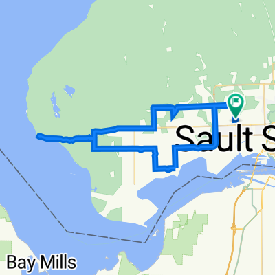
Went to the Hub Trail. Felt tired. Went south onto Carmen's Way. Felt VERY tired. Pushed through it to the boardwalk. Had a better time. Kept on until the library, Queen Street, Bellveiw. Had an AWESOME time. Ate some ice cream. Booted it home.
- -:--
- Duration
- 17.3 km
- Distance
- 49 m
- Ascent
- 49 m
- Descent
- ---
- Avg. speed
- ---
- Max. altitude
Route quality
Waytypes & surfaces along the route
Waytypes
Quiet road
4.4 km
(25 %)
Cycleway
3.1 km
(18 %)
Surfaces
Paved
8.2 km
(48 %)
Asphalt
8.2 km
(48 %)
Undefined
9.1 km
(52 %)
Continue with Bikemap
Use, edit, or download this cycling route
You would like to ride June 29 Ride or customize it for your own trip? Here is what you can do with this Bikemap route:
Free features
- Save this route as favorite or in collections
- Copy & plan your own version of this route
- Sync your route with Garmin or Wahoo
Premium features
Free trial for 3 days, or one-time payment. More about Bikemap Premium.
- Navigate this route on iOS & Android
- Export a GPX / KML file of this route
- Create your custom printout (try it for free)
- Download this route for offline navigation
Discover more Premium features.
Get Bikemap PremiumFrom our community
Other popular routes starting in Sault Ste. Marie
 Here and there around the city
- Distance
- 30.3 km
- Ascent
- 124 m
- Descent
- 124 m
- Location
- Sault Ste. Marie, Ontario, Canada
 Thursday
- Distance
- 44.5 km
- Ascent
- 210 m
- Descent
- 210 m
- Location
- Sault Ste. Marie, Ontario, Canada
 40km Airport Way
- Distance
- 41.9 km
- Ascent
- 136 m
- Descent
- 139 m
- Location
- Sault Ste. Marie, Ontario, Canada
 Michigan-Ontario Trip 2016
- Distance
- 1,851.1 km
- Ascent
- 657 m
- Descent
- 825 m
- Location
- Sault Ste. Marie, Ontario, Canada
 spring eastend
- Distance
- 16.3 km
- Ascent
- 23 m
- Descent
- 23 m
- Location
- Sault Ste. Marie, Ontario, Canada
 6of12 SouthCentralON - 01 Sault Ste. Marie, ON to Thessalon, ON (Thessalon Lakeside Park Campground) 84km
- Distance
- 84 km
- Ascent
- 159 m
- Descent
- 226 m
- Location
- Sault Ste. Marie, Ontario, Canada
 50 Eastern Ave, Sault Ste. Marie to 699 Trunk Rd, Sault Ste. Marie
- Distance
- 24.2 km
- Ascent
- 78 m
- Descent
- 79 m
- Location
- Sault Ste. Marie, Ontario, Canada
 June 29 Ride
- Distance
- 17.3 km
- Ascent
- 49 m
- Descent
- 49 m
- Location
- Sault Ste. Marie, Ontario, Canada
Open it in the app