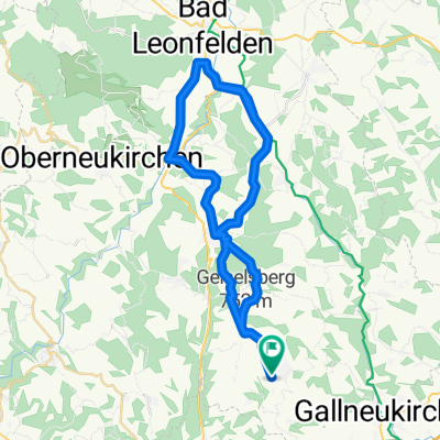
Trail – GIS Runde
A cycling route starting in Altenberg bei Linz, Upper Austria, Austria.
Overview
About this route
Schöne Runde über die GIS und rund um den Haselgraben.
- -:--
- Duration
- 34.4 km
- Distance
- 870 m
- Ascent
- 872 m
- Descent
- ---
- Avg. speed
- ---
- Avg. speed
Route quality
Waytypes & surfaces along the route
Waytypes
Track
12 km
(35 %)
Road
10.5 km
(31 %)
Surfaces
Paved
12.9 km
(37 %)
Unpaved
13.1 km
(38 %)
Asphalt
11.7 km
(34 %)
Ground
9 km
(26 %)
Continue with Bikemap
Use, edit, or download this cycling route
You would like to ride Trail – GIS Runde or customize it for your own trip? Here is what you can do with this Bikemap route:
Free features
- Save this route as favorite or in collections
- Copy & plan your own version of this route
- Sync your route with Garmin or Wahoo
Premium features
Free trial for 3 days, or one-time payment. More about Bikemap Premium.
- Navigate this route on iOS & Android
- Export a GPX / KML file of this route
- Create your custom printout (try it for free)
- Download this route for offline navigation
Discover more Premium features.
Get Bikemap PremiumFrom our community
Other popular routes starting in Altenberg bei Linz
- Grammastetten1
- Distance
- 75.7 km
- Ascent
- 912 m
- Descent
- 912 m
- Location
- Altenberg bei Linz, Upper Austria, Austria
- Leitnerstraße 10, Mittertreffling nach Gasstraße, Linz
- Distance
- 12.1 km
- Ascent
- 56 m
- Descent
- 163 m
- Location
- Altenberg bei Linz, Upper Austria, Austria
- Hellmonsödt AV160
- Distance
- 14.3 km
- Ascent
- 609 m
- Descent
- 79 m
- Location
- Altenberg bei Linz, Upper Austria, Austria
- Trail Windpassing – Dornach
- Distance
- 3.2 km
- Ascent
- 45 m
- Descent
- 387 m
- Location
- Altenberg bei Linz, Upper Austria, Austria
- Altenberg-Schnkfeldn-Gallneukirchen
- Distance
- 50 km
- Ascent
- 756 m
- Descent
- 767 m
- Location
- Altenberg bei Linz, Upper Austria, Austria
- Im Landlgrund 28, Altenberg bei Linz nach Im Landlgrund 28, Altenberg bei Linz
- Distance
- 25.9 km
- Ascent
- 496 m
- Descent
- 495 m
- Location
- Altenberg bei Linz, Upper Austria, Austria
- Altenberg und drei Gewässer
- Distance
- 44.7 km
- Ascent
- 776 m
- Descent
- 789 m
- Location
- Altenberg bei Linz, Upper Austria, Austria
- Trail Schatzweg
- Distance
- 4 km
- Ascent
- 172 m
- Descent
- 170 m
- Location
- Altenberg bei Linz, Upper Austria, Austria
Open it in the app