

PUNTA CORVO DA FIUME MAGRA
A cycling route starting in Ameglia, Liguria, Italy.
Overview
About this route
XX about 3.5 km of running with backpack, about 1h30
- -:--
- Duration
- 3.4 km
- Distance
- 274 m
- Ascent
- 285 m
- Descent
- ---
- Avg. speed
- ---
- Max. altitude

Continue with Bikemap
Use, edit, or download this cycling route
You would like to ride PUNTA CORVO DA FIUME MAGRA or customize it for your own trip? Here is what you can do with this Bikemap route:
Free features
- Save this route as favorite or in collections
- Copy & plan your own version of this route
- Sync your route with Garmin or Wahoo
Premium features
Free trial for 3 days, or one-time payment. More about Bikemap Premium.
- Navigate this route on iOS & Android
- Export a GPX / KML file of this route
- Create your custom printout (try it for free)
- Download this route for offline navigation
Discover more Premium features.
Get Bikemap PremiumFrom our community
Other popular routes starting in Ameglia
 La Spezia - Rom (mit Bergetappen
- Distance
- 619.3 km
- Ascent
- 7,390 m
- Descent
- 7,613 m
- Location
- Ameglia, Liguria, Italy
 cinque terre
- Distance
- 65.9 km
- Ascent
- 1,857 m
- Descent
- 1,859 m
- Location
- Ameglia, Liguria, Italy
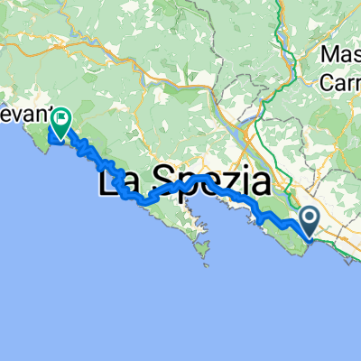
 Ameglia - La Spezia
- Distance
- 17.8 km
- Ascent
- 374 m
- Descent
- 452 m
- Location
- Ameglia, Liguria, Italy
 Da Viale 25 Aprile, Ameglia a Viale 25 Aprile, Ameglia
- Distance
- 5.6 km
- Ascent
- 4 m
- Descent
- 4 m
- Location
- Ameglia, Liguria, Italy
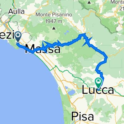 2022_per Toscana_4_Ameglia-Lucca
- Distance
- 103.3 km
- Ascent
- 2,593 m
- Descent
- 2,576 m
- Location
- Ameglia, Liguria, Italy
 Da Via Crociata 33, Ameglia a Via Crociata 33, Ameglia
- Distance
- 11.1 km
- Ascent
- 42 m
- Descent
- 41 m
- Location
- Ameglia, Liguria, Italy
 PUNTA CORVO DA FIUME MAGRA
- Distance
- 3.4 km
- Ascent
- 274 m
- Descent
- 285 m
- Location
- Ameglia, Liguria, Italy
 montemarcello1
- Distance
- 25.9 km
- Ascent
- 511 m
- Descent
- 490 m
- Location
- Ameglia, Liguria, Italy
Open it in the app