Vogel 1
- 95.6 km
- 1,329 m
- 899 m
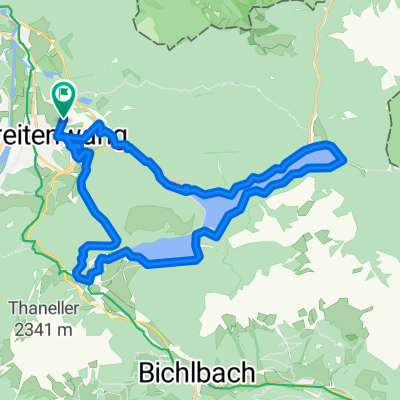
- Breitenwang, Tyrol, Austria
A cycling route starting in Breitenwang, Tyrol, Austria.
Overview
Scenic tour along the Altenbergweg, passing the Urisee and Plansee
created this 10 years ago
Continue with Bikemap
You would like to ride Um das Hochjoch or customize it for your own trip? Here is what you can do with this Bikemap route:
Free trial for 3 days, or one-time payment. More about Bikemap Premium.
Discover more Premium features.
Get Bikemap PremiumFrom our community
Open it in the app