
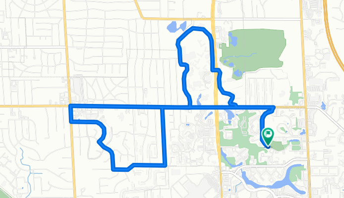
Usual Route
A cycling route starting in East Grand Rapids, Michigan, United States.
Overview
About this route
Usual route down Burton, through Calvin College's campus, down Burton from Calvin's exit, through Inverness, down Barfield, Alger, Up Woodcliff, down Burton towards E. Beltline back home to Rowland Ave. SE.
- -:--
- Duration
- 10.6 km
- Distance
- 58 m
- Ascent
- 57 m
- Descent
- ---
- Avg. speed
- ---
- Max. altitude
Route quality
Waytypes & surfaces along the route
Waytypes
Quiet road
5.9 km
(55 %)
Access road
2.4 km
(23 %)
Surfaces
Paved
1.4 km
(13 %)
Asphalt
1.4 km
(13 %)
Undefined
9.3 km
(87 %)
Continue with Bikemap
Use, edit, or download this cycling route
You would like to ride Usual Route or customize it for your own trip? Here is what you can do with this Bikemap route:
Free features
- Save this route as favorite or in collections
- Copy & plan your own version of this route
- Sync your route with Garmin or Wahoo
Premium features
Free trial for 3 days, or one-time payment. More about Bikemap Premium.
- Navigate this route on iOS & Android
- Export a GPX / KML file of this route
- Create your custom printout (try it for free)
- Download this route for offline navigation
Discover more Premium features.
Get Bikemap PremiumFrom our community
Other popular routes starting in East Grand Rapids
 68th Street
- Distance
- 25.8 km
- Ascent
- 108 m
- Descent
- 108 m
- Location
- East Grand Rapids, Michigan, United States
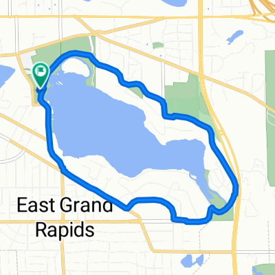
 reeds lake
- Distance
- 21 km
- Ascent
- 438 m
- Descent
- 471 m
- Location
- East Grand Rapids, Michigan, United States
 Usual Route
- Distance
- 10.6 km
- Ascent
- 58 m
- Descent
- 57 m
- Location
- East Grand Rapids, Michigan, United States
 2115 Union Ave SE, Grand Rapids to 1415 Maynard Ave SW, Walker
- Distance
- 12.9 km
- Ascent
- 65 m
- Descent
- 88 m
- Location
- East Grand Rapids, Michigan, United States
 Recovered Route
- Distance
- 30.5 km
- Ascent
- 316 m
- Descent
- 342 m
- Location
- East Grand Rapids, Michigan, United States
 Grand Haven
- Distance
- 60.3 km
- Ascent
- 140 m
- Descent
- 194 m
- Location
- East Grand Rapids, Michigan, United States
 Easy ride in Grand Rapids
- Distance
- 6.8 km
- Ascent
- 29 m
- Descent
- 52 m
- Location
- East Grand Rapids, Michigan, United States
 Relaxed route in East Grand Rapids
- Distance
- 7.3 km
- Ascent
- 60 m
- Descent
- 60 m
- Location
- East Grand Rapids, Michigan, United States
Open it in the app