

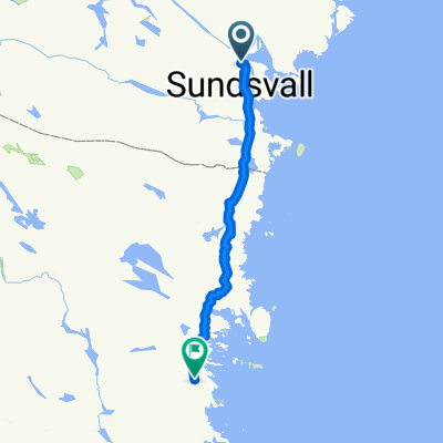
ARTUR ETAPP 8
A cycling route starting in Timrå, Västernorrland County, Sweden.
Overview
About this route
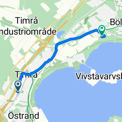
The segment ends with a sprint before the roundabout at Fagerviksfältet.
- -:--
- Duration
- 9.1 km
- Distance
- 63 m
- Ascent
- 72 m
- Descent
- ---
- Avg. speed
- ---
- Max. altitude
Route quality
Waytypes & surfaces along the route
Waytypes
Road
4.1 km
(45 %)
Path
1.2 km
(13 %)
Surfaces
Paved
3.3 km
(36 %)
Asphalt
3.3 km
(36 %)
Undefined
5.8 km
(64 %)
Continue with Bikemap
Use, edit, or download this cycling route
You would like to ride ARTUR ETAPP 8 or customize it for your own trip? Here is what you can do with this Bikemap route:
Free features
- Save this route as favorite or in collections
- Copy & plan your own version of this route
- Sync your route with Garmin or Wahoo
Premium features
Free trial for 3 days, or one-time payment. More about Bikemap Premium.
- Navigate this route on iOS & Android
- Export a GPX / KML file of this route
- Create your custom printout (try it for free)
- Download this route for offline navigation
Discover more Premium features.
Get Bikemap PremiumFrom our community
Other popular routes starting in Timrå
 TIMRÅ GP. Långa banan
- Distance
- 3.2 km
- Ascent
- 12 m
- Descent
- 9 m
- Location
- Timrå, Västernorrland County, Sweden
 Vasaprepp!
- Distance
- 75.8 km
- Ascent
- 691 m
- Descent
- 631 m
- Location
- Timrå, Västernorrland County, Sweden
 Timrå - Iggesund
- Distance
- 137.7 km
- Ascent
- 1,089 m
- Descent
- 1,081 m
- Location
- Timrå, Västernorrland County, Sweden
 ART Timrå GP Korta banan
- Distance
- 1.6 km
- Ascent
- 13 m
- Descent
- 13 m
- Location
- Timrå, Västernorrland County, Sweden
 EV49_Timra_Ullanger_131x1240
- Distance
- 130.6 km
- Ascent
- 614 m
- Descent
- 613 m
- Location
- Timrå, Västernorrland County, Sweden
 Köpmangatan, Timrå to Solrosvägen, Sörberge
- Distance
- 3.5 km
- Ascent
- 7 m
- Descent
- 45 m
- Location
- Timrå, Västernorrland County, Sweden
 TIMRÅ GP
- Distance
- 1.6 km
- Ascent
- 8 m
- Descent
- 8 m
- Location
- Timrå, Västernorrland County, Sweden
 Day 17
- Distance
- 83.8 km
- Ascent
- 488 m
- Descent
- 502 m
- Location
- Timrå, Västernorrland County, Sweden
Open it in the app