

Independence Day metric
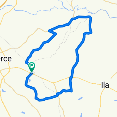
A cycling route starting in Commerce, Georgia, United States.
Overview
About this route
Small rollers with the exception of Moccasin gap.
- -:--
- Duration
- 107.3 km
- Distance
- 536 m
- Ascent
- 536 m
- Descent
- ---
- Avg. speed
- ---
- Max. altitude
Route quality
Waytypes & surfaces along the route
Waytypes
Quiet road
54.2 km
(50 %)
Road
42.4 km
(40 %)
Surfaces
Paved
18.9 km
(18 %)
Unpaved
0.3 km
(<1 %)
Paved (undefined)
11.6 km
(11 %)
Asphalt
7 km
(7 %)
Continue with Bikemap
Use, edit, or download this cycling route
You would like to ride Independence Day metric or customize it for your own trip? Here is what you can do with this Bikemap route:
Free features
- Save this route as favorite or in collections
- Copy & plan your own version of this route
- Split it into stages to create a multi-day tour
- Sync your route with Garmin or Wahoo
Premium features
Free trial for 3 days, or one-time payment. More about Bikemap Premium.
- Navigate this route on iOS & Android
- Export a GPX / KML file of this route
- Create your custom printout (try it for free)
- Download this route for offline navigation
Discover more Premium features.
Get Bikemap PremiumFrom our community
Other popular routes starting in Commerce
 State Street to Athens
- Distance
- 66.3 km
- Ascent
- 492 m
- Descent
- 492 m
- Location
- Commerce, Georgia, United States
 Banks county loop
- Distance
- 50 km
- Ascent
- 378 m
- Descent
- 378 m
- Location
- Commerce, Georgia, United States
 Maysville short loop
- Distance
- 46.3 km
- Ascent
- 276 m
- Descent
- 275 m
- Location
- Commerce, Georgia, United States
 five points, waterworks
- Distance
- 51.2 km
- Ascent
- 351 m
- Descent
- 352 m
- Location
- Commerce, Georgia, United States
 jot em down
- Distance
- 36 km
- Ascent
- 251 m
- Descent
- 251 m
- Location
- Commerce, Georgia, United States
 State Street Bicycles 100K
- Distance
- 98.9 km
- Ascent
- 575 m
- Descent
- 577 m
- Location
- Commerce, Georgia, United States
 State Street Bicycles "A" course
- Distance
- 49.8 km
- Ascent
- 363 m
- Descent
- 363 m
- Location
- Commerce, Georgia, United States
 commerce to athens
- Distance
- 67.8 km
- Ascent
- 422 m
- Descent
- 422 m
- Location
- Commerce, Georgia, United States
Open it in the app