
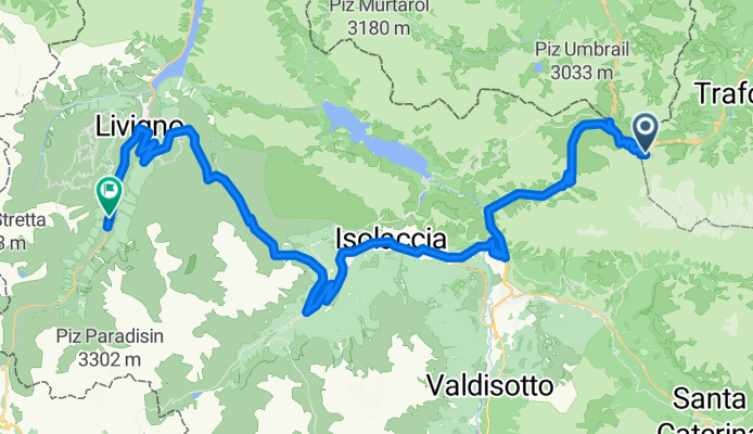
2015_6_Stilfserjoch - Livigno
A cycling route starting in Sant'Antonio, Lombardy, Italy.
Overview
About this route
6.Tag
- -:--
- Duration
- 61.2 km
- Distance
- 1,231 m
- Ascent
- 2,135 m
- Descent
- ---
- Avg. speed
- ---
- Max. altitude

Route quality
Waytypes & surfaces along the route
Waytypes
Quiet road
4.3 km
(7 %)
Road
3.1 km
(5 %)
Surfaces
Paved
57.5 km
(94 %)
Asphalt
57.5 km
(94 %)
Undefined
3.7 km
(6 %)
Continue with Bikemap
Use, edit, or download this cycling route
You would like to ride 2015_6_Stilfserjoch - Livigno or customize it for your own trip? Here is what you can do with this Bikemap route:
Free features
- Save this route as favorite or in collections
- Copy & plan your own version of this route
- Sync your route with Garmin or Wahoo
Premium features
Free trial for 3 days, or one-time payment. More about Bikemap Premium.
- Navigate this route on iOS & Android
- Export a GPX / KML file of this route
- Create your custom printout (try it for free)
- Download this route for offline navigation
Discover more Premium features.
Get Bikemap PremiumFrom our community
Other popular routes starting in Sant'Antonio
 Santa Caterina - Passo del Gavia
- Distance
- 13.3 km
- Ascent
- 970 m
- Descent
- 87 m
- Location
- Sant'Antonio, Lombardy, Italy
 Gavia Pass Runde
- Distance
- 138.6 km
- Ascent
- 3,211 m
- Descent
- 3,211 m
- Location
- Sant'Antonio, Lombardy, Italy
 Santa Caterina - Bormio - Passo dello Stelvio & zurück
- Distance
- 67.6 km
- Ascent
- 2,120 m
- Descent
- 2,120 m
- Location
- Sant'Antonio, Lombardy, Italy
- Route zu Armon Greenblu Hotel & Wellness
- Distance
- 111.7 km
- Ascent
- 4,766 m
- Descent
- 5,245 m
- Location
- Sant'Antonio, Lombardy, Italy
 2.Etapa - BRM-P.Stelvio-Umbrailpass-Prato allo Stelvio-P.Stelvio-BRM
- Distance
- 114.4 km
- Ascent
- 3,403 m
- Descent
- 3,404 m
- Location
- Sant'Antonio, Lombardy, Italy
 September in Italy
- Distance
- 1,050.7 km
- Ascent
- 3,955 m
- Descent
- 6,358 m
- Location
- Sant'Antonio, Lombardy, Italy
 03.09.2016 Goldseetrail
- Distance
- 31.9 km
- Ascent
- 513 m
- Descent
- 2,307 m
- Location
- Sant'Antonio, Lombardy, Italy
 Santa Caterina-Passo Gavia-Passo Mortirolo-Santa Caterina
- Distance
- 107.2 km
- Ascent
- 2,942 m
- Descent
- 2,942 m
- Location
- Sant'Antonio, Lombardy, Italy
Open it in the app