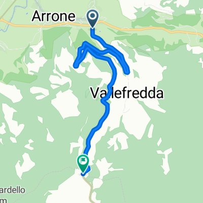
GWN Tour Cascata Triponzo - Andata
A cycling route starting in Arrone, Umbria, Italy.
Overview
About this route
Percorso della Greenway del Nera dalla Cascata a Borgo Cerreto, che unisce il primo tratto fino a S.Anatolia di Narco, prevalentemente pianeggiante, con il tratto lungo il fiume Nera della ex Ferrovia Spoleto Norcia. In questo tratto si incontrano diverse brevi gallerie e una lunga 400 m leggermente in curva per cui è necessario dotarsi di faretti per l'illuminazione. Arrivati in località Balza Tagliata, si risale verso triponzo dove c'è la confluenza tra il fiume Corno e il Nera, per poi ridiscendere a Borgo Cerreto e percorrere un tratto della SS Valnerina fino a Piedipaterno per poi riprendere la vecchia ferrovia fino a Caste San Felice.
- -:--
- Duration
- 61.4 km
- Distance
- 494 m
- Ascent
- 421 m
- Descent
- ---
- Avg. speed
- ---
- Avg. speed
Route quality
Waytypes & surfaces along the route
Waytypes
Track
34.7 km
(57 %)
Busy road
12 km
(19 %)
Surfaces
Paved
3.7 km
(6 %)
Unpaved
33.4 km
(54 %)
Gravel
24.9 km
(41 %)
Loose gravel
4.9 km
(8 %)
Continue with Bikemap
Use, edit, or download this cycling route
You would like to ride GWN Tour Cascata Triponzo - Andata or customize it for your own trip? Here is what you can do with this Bikemap route:
Free features
- Save this route as favorite or in collections
- Copy & plan your own version of this route
- Sync your route with Garmin or Wahoo
Premium features
Free trial for 3 days, or one-time payment. More about Bikemap Premium.
- Navigate this route on iOS & Android
- Export a GPX / KML file of this route
- Create your custom printout (try it for free)
- Download this route for offline navigation
Discover more Premium features.
Get Bikemap PremiumFrom our community
Other popular routes starting in Arrone
- marmore-greccio
- Distance
- 19.5 km
- Ascent
- 772 m
- Descent
- 450 m
- Location
- Arrone, Umbria, Italy
- GWN Tour Cascata Triponzo - Andata
- Distance
- 61.4 km
- Ascent
- 494 m
- Descent
- 421 m
- Location
- Arrone, Umbria, Italy
- GRAND TOUR RANDO STANDARD 200 KM.
- Distance
- 202.8 km
- Ascent
- 2,127 m
- Descent
- 2,126 m
- Location
- Arrone, Umbria, Italy
- GWN Tour Cascata Ferentillo
- Distance
- 24.5 km
- Ascent
- 160 m
- Descent
- 162 m
- Location
- Arrone, Umbria, Italy
- GRAND TOUR RANDO BASIC 100 KM.
- Distance
- 104.1 km
- Ascent
- 1,314 m
- Descent
- 1,315 m
- Location
- Arrone, Umbria, Italy
- GTR Extreme - 1 Tappa - Arrone - Narni
- Distance
- 69.1 km
- Ascent
- 911 m
- Descent
- 1,029 m
- Location
- Arrone, Umbria, Italy
- GTR dell'Umbria - SUPER RANDONNEE
- Distance
- 977.4 km
- Ascent
- 4,900 m
- Descent
- 4,896 m
- Location
- Arrone, Umbria, Italy
- GRAND TOUR RANDO PERMANENTE (SEGNALETICA)
- Distance
- 322.2 km
- Ascent
- 2,902 m
- Descent
- 2,901 m
- Location
- Arrone, Umbria, Italy