

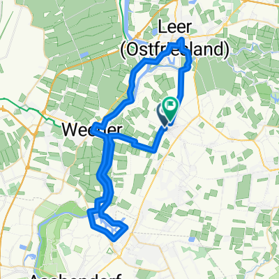
20150702_160046.gpx
A cycling route starting in Weener, Lower Saxony, Germany.
Overview
About this route
TEASI track
- -:--
- Duration
- 21.5 km
- Distance
- 10 m
- Ascent
- 8 m
- Descent
- ---
- Avg. speed
- ---
- Max. altitude

Route quality
Waytypes & surfaces along the route
Waytypes
Path
7.3 km
(34 %)
Quiet road
4.9 km
(23 %)
Surfaces
Paved
11.6 km
(54 %)
Asphalt
10.8 km
(50 %)
Concrete
0.9 km
(4 %)
Undefined
9.9 km
(46 %)
Continue with Bikemap
Use, edit, or download this cycling route
You would like to ride 20150702_160046.gpx or customize it for your own trip? Here is what you can do with this Bikemap route:
Free features
- Save this route as favorite or in collections
- Copy & plan your own version of this route
- Sync your route with Garmin or Wahoo
Premium features
Free trial for 3 days, or one-time payment. More about Bikemap Premium.
- Navigate this route on iOS & Android
- Export a GPX / KML file of this route
- Create your custom printout (try it for free)
- Download this route for offline navigation
Discover more Premium features.
Get Bikemap PremiumFrom our community
Other popular routes starting in Weener
 2. Etappe: Weener - Papenburg - Weener
- Distance
- 14 km
- Ascent
- 11 m
- Descent
- 8 m
- Location
- Weener, Lower Saxony, Germany
 Schwoog nach Conrebbersweg
- Distance
- 51.9 km
- Ascent
- 60 m
- Descent
- 58 m
- Location
- Weener, Lower Saxony, Germany
 Schulstraße 5–9, Weener nach Schulstraße 5–9, Weener
- Distance
- 54.8 km
- Ascent
- 9 m
- Descent
- 9 m
- Location
- Weener, Lower Saxony, Germany
 Ringstraße 28, Weener nach Ringstraße 28A, Weener
- Distance
- 25.1 km
- Ascent
- 80 m
- Descent
- 83 m
- Location
- Weener, Lower Saxony, Germany
 Am Rennschloot 22a nach Am Rennschloot
- Distance
- 32.3 km
- Ascent
- 19 m
- Descent
- 20 m
- Location
- Weener, Lower Saxony, Germany
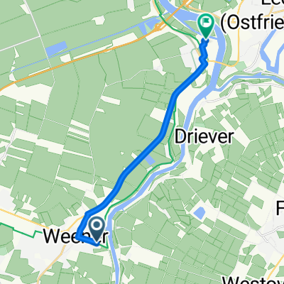 Von Weener bis Leer (Ostfriesland)
- Distance
- 9.5 km
- Ascent
- 10 m
- Descent
- 6 m
- Location
- Weener, Lower Saxony, Germany
 Knackige Fahrt in Weener
- Distance
- 63.3 km
- Ascent
- 161 m
- Descent
- 151 m
- Location
- Weener, Lower Saxony, Germany
 Nordseeküstenradweg-Jever bis Weener
- Distance
- 209.9 km
- Ascent
- 14 m
- Descent
- 17 m
- Location
- Weener, Lower Saxony, Germany
Open it in the app