

Sulzbach-Breuberg-Otzberg-Großostheim
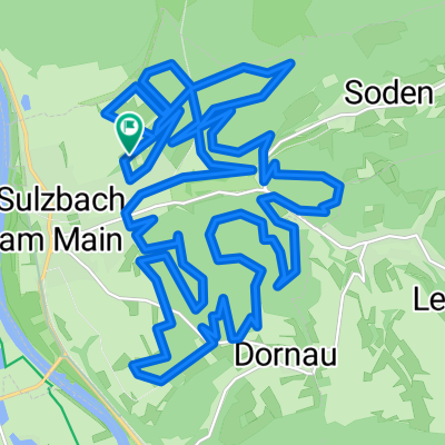
A cycling route starting in Sulzbach am Main, Bavaria, Germany.
Overview
About this route
Two remarkable castles (or fortresses), also connected by an official cycling route, which I did not follow with my road bike.
Towards Mömlingen, mostly little traffic (ok, it was a Sunday ride), often with well-developed bike paths. The nicest section lies between the two castles: a narrow road (Ober-Nauses) with a slight incline.
- -:--
- Duration
- 76.1 km
- Distance
- 962 m
- Ascent
- 902 m
- Descent
- ---
- Avg. speed
- 353 m
- Max. altitude

Route quality
Waytypes & surfaces along the route
Waytypes
Road
26.6 km
(35 %)
Quiet road
8.4 km
(11 %)
Surfaces
Paved
60.1 km
(79 %)
Unpaved
3 km
(4 %)
Asphalt
56.3 km
(74 %)
Paved (undefined)
3 km
(4 %)
Continue with Bikemap
Use, edit, or download this cycling route
You would like to ride Sulzbach-Breuberg-Otzberg-Großostheim or customize it for your own trip? Here is what you can do with this Bikemap route:
Free features
- Save this route as favorite or in collections
- Copy & plan your own version of this route
- Sync your route with Garmin or Wahoo
Premium features
Free trial for 3 days, or one-time payment. More about Bikemap Premium.
- Navigate this route on iOS & Android
- Export a GPX / KML file of this route
- Create your custom printout (try it for free)
- Download this route for offline navigation
Discover more Premium features.
Get Bikemap PremiumFrom our community
Other popular routes starting in Sulzbach am Main
 Spessart-Hafenlohrtal-Engländer
- Distance
- 122.7 km
- Ascent
- 778 m
- Descent
- 778 m
- Location
- Sulzbach am Main, Bavaria, Germany
 Honischer Weizenrunde
- Distance
- 26.8 km
- Ascent
- 525 m
- Descent
- 525 m
- Location
- Sulzbach am Main, Bavaria, Germany
 1. ausgeschilderte MTB Strecke Sulzbach
- Distance
- 28.7 km
- Ascent
- 542 m
- Descent
- 542 m
- Location
- Sulzbach am Main, Bavaria, Germany
 Sulzbach-Eichelsbach-Geishöhe-Volkersbrunn
- Distance
- 49.7 km
- Ascent
- 957 m
- Descent
- 858 m
- Location
- Sulzbach am Main, Bavaria, Germany
 CTF-Sulzbach-2009-Hessen
- Distance
- 31.6 km
- Ascent
- 896 m
- Descent
- 849 m
- Location
- Sulzbach am Main, Bavaria, Germany
 1. ausgeschilderte MTB Strecke Sulzbach
- Distance
- 28.7 km
- Ascent
- 573 m
- Descent
- 576 m
- Location
- Sulzbach am Main, Bavaria, Germany
 Volkersbrunn-Mespelbrunn-Weibersbrunn-Eschau-Obernburg
- Distance
- 68.7 km
- Ascent
- 629 m
- Descent
- 629 m
- Location
- Sulzbach am Main, Bavaria, Germany
 Sulzbach-Breuberg-Otzberg-Großostheim
- Distance
- 76.1 km
- Ascent
- 962 m
- Descent
- 902 m
- Location
- Sulzbach am Main, Bavaria, Germany
Open it in the app