
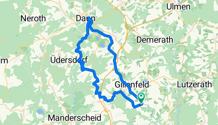
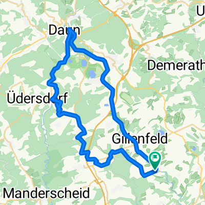
track1- Strohn
A cycling route starting in Strohn, Rhineland-Palatinate, Germany.
Overview
About this route
- 3 h 10 min
- Duration
- 36.5 km
- Distance
- 343 m
- Ascent
- 342 m
- Descent
- 11.5 km/h
- Avg. speed
- ---
- Max. altitude
Route quality
Waytypes & surfaces along the route
Waytypes
Track
14.6 km
(40 %)
Cycleway
10.6 km
(29 %)
Surfaces
Paved
21.2 km
(58 %)
Unpaved
11.3 km
(31 %)
Asphalt
20.5 km
(56 %)
Gravel
5.1 km
(14 %)
Continue with Bikemap
Use, edit, or download this cycling route
You would like to ride track1- Strohn or customize it for your own trip? Here is what you can do with this Bikemap route:
Free features
- Save this route as favorite or in collections
- Copy & plan your own version of this route
- Sync your route with Garmin or Wahoo
Premium features
Free trial for 3 days, or one-time payment. More about Bikemap Premium.
- Navigate this route on iOS & Android
- Export a GPX / KML file of this route
- Create your custom printout (try it for free)
- Download this route for offline navigation
Discover more Premium features.
Get Bikemap PremiumFrom our community
Other popular routes starting in Strohn
 Auf dem Berg 4 - Auf dem Berg 3
- Distance
- 32.7 km
- Ascent
- 403 m
- Descent
- 404 m
- Location
- Strohn, Rhineland-Palatinate, Germany
 Strohn - Udler - Brockscheid - Eckfeld - MMR Gillfeld
- Distance
- 20.5 km
- Ascent
- 271 m
- Descent
- 280 m
- Location
- Strohn, Rhineland-Palatinate, Germany
 Tour 4.8.19
- Distance
- 19.5 km
- Ascent
- 284 m
- Descent
- 283 m
- Location
- Strohn, Rhineland-Palatinate, Germany
 Sportfest Tour
- Distance
- 32.4 km
- Ascent
- 435 m
- Descent
- 435 m
- Location
- Strohn, Rhineland-Palatinate, Germany
 track1- Strohn
- Distance
- 36.5 km
- Ascent
- 343 m
- Descent
- 342 m
- Location
- Strohn, Rhineland-Palatinate, Germany
 Stromer Märchen, Immerather Maar, Strotzbüsch, Sprink, Strohn
- Distance
- 17 km
- Ascent
- 249 m
- Descent
- 247 m
- Location
- Strohn, Rhineland-Palatinate, Germany
 Ausfahrt durch Strohn
- Distance
- 14.8 km
- Ascent
- 191 m
- Descent
- 195 m
- Location
- Strohn, Rhineland-Palatinate, Germany
 "lockere" Freitag abend runde
- Distance
- 27.9 km
- Ascent
- 245 m
- Descent
- 256 m
- Location
- Strohn, Rhineland-Palatinate, Germany
Open it in the app