

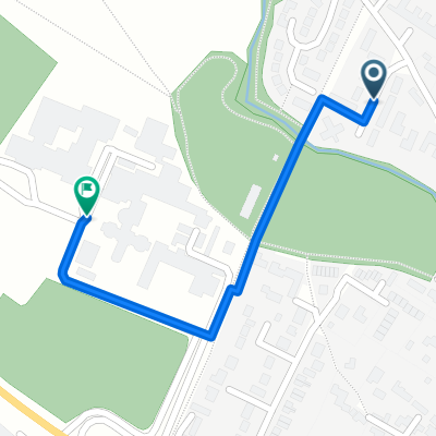
Around Haverhill
A cycling route starting in Linton, England, United Kingdom.
Overview
About this route
Keeping off major roads. Pause for pub in Steeple Bumpstead.
- -:--
- Duration
- 52.5 km
- Distance
- 258 m
- Ascent
- 258 m
- Descent
- ---
- Avg. speed
- ---
- Max. altitude
Route quality
Waytypes & surfaces along the route
Waytypes
Road
32 km
(61 %)
Quiet road
11 km
(21 %)
Undefined
9.5 km
(18 %)
Surfaces
Paved
5.3 km
(10 %)
Asphalt
5.3 km
(10 %)
Undefined
47.3 km
(90 %)
Continue with Bikemap
Use, edit, or download this cycling route
You would like to ride Around Haverhill or customize it for your own trip? Here is what you can do with this Bikemap route:
Free features
- Save this route as favorite or in collections
- Copy & plan your own version of this route
- Sync your route with Garmin or Wahoo
Premium features
Free trial for 3 days, or one-time payment. More about Bikemap Premium.
- Navigate this route on iOS & Android
- Export a GPX / KML file of this route
- Create your custom printout (try it for free)
- Download this route for offline navigation
Discover more Premium features.
Get Bikemap PremiumFrom our community
Other popular routes starting in Linton
 Linton to Hare St (motorbike)
- Distance
- 31.5 km
- Ascent
- 235 m
- Descent
- 180 m
- Location
- Linton, England, United Kingdom
 151 High St, Cambridge to Church View, 30 Church St, Oakham
- Distance
- 117 km
- Ascent
- 665 m
- Descent
- 574 m
- Location
- Linton, England, United Kingdom
 Linton Off Road
- Distance
- 18.7 km
- Ascent
- 143 m
- Descent
- 147 m
- Location
- Linton, England, United Kingdom
 151 High Street, Cambridge to 51 Church Street, Oakham
- Distance
- 113.1 km
- Ascent
- 520 m
- Descent
- 430 m
- Location
- Linton, England, United Kingdom
 151 High St, Cambridge to Church View, 30 Church St, Oakham
- Distance
- 117 km
- Ascent
- 674 m
- Descent
- 583 m
- Location
- Linton, England, United Kingdom
 Around Haverhill
- Distance
- 52.5 km
- Ascent
- 258 m
- Descent
- 258 m
- Location
- Linton, England, United Kingdom
 Palmers Close 20, Linton to Linton Village Coll forecourt
- Distance
- 0.6 km
- Ascent
- 3 m
- Descent
- 4 m
- Location
- Linton, England, United Kingdom
 ,2Hildersham-Kings Lynn103
- Distance
- 101.8 km
- Ascent
- 185 m
- Descent
- 216 m
- Location
- Linton, England, United Kingdom
Open it in the app