

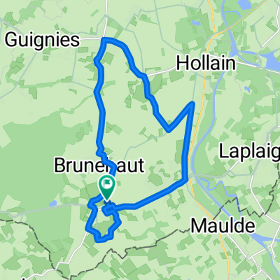
Road #P06 - 43N060
A cycling route starting in Antoing, Wallonia, Belgium.
Overview
About this route
Road #P06 - 43N060
- -:--
- Duration
- 34.2 km
- Distance
- 143 m
- Ascent
- 140 m
- Descent
- ---
- Avg. speed
- ---
- Max. altitude

Route quality
Waytypes & surfaces along the route
Waytypes
Road
16.1 km
(47 %)
Cycleway
8.2 km
(24 %)
Surfaces
Paved
10.9 km
(32 %)
Unpaved
0.7 km
(2 %)
Asphalt
7.9 km
(23 %)
Concrete
2.1 km
(6 %)
Route highlights
Points of interest along the route
Point of interest after 11.6 km
Station irceline 43N060
Continue with Bikemap
Use, edit, or download this cycling route
You would like to ride Road #P06 - 43N060 or customize it for your own trip? Here is what you can do with this Bikemap route:
Free features
- Save this route as favorite or in collections
- Copy & plan your own version of this route
- Sync your route with Garmin or Wahoo
Premium features
Free trial for 3 days, or one-time payment. More about Bikemap Premium.
- Navigate this route on iOS & Android
- Export a GPX / KML file of this route
- Create your custom printout (try it for free)
- Download this route for offline navigation
Discover more Premium features.
Get Bikemap PremiumFrom our community
Other popular routes starting in Antoing
 Inlinemap "Bush Classic" Adapted Rollers 50 Km
- Distance
- 49.8 km
- Ascent
- 126 m
- Descent
- 123 m
- Location
- Antoing, Wallonia, Belgium
 Doornik Saint Quentin
- Distance
- 104.7 km
- Ascent
- 277 m
- Descent
- 213 m
- Location
- Antoing, Wallonia, Belgium
 Road #P04 - Tournai Airport
- Distance
- 21.4 km
- Ascent
- 65 m
- Descent
- 65 m
- Location
- Antoing, Wallonia, Belgium
 De Rue Rosée 14, Brunehaut à Rue Rosée 14, Brunehaut
- Distance
- 16.6 km
- Ascent
- 61 m
- Descent
- 58 m
- Location
- Antoing, Wallonia, Belgium
 Road #P03 - Callenelle
- Distance
- 14.5 km
- Ascent
- 71 m
- Descent
- 69 m
- Location
- Antoing, Wallonia, Belgium
 Vélotaf 2805
- Distance
- 32.5 km
- Ascent
- 66 m
- Descent
- 83 m
- Location
- Antoing, Wallonia, Belgium
 Itinéraire vers Résidence du Bourgeon 23, Tournai
- Distance
- 3.8 km
- Ascent
- 0 m
- Descent
- 50 m
- Location
- Antoing, Wallonia, Belgium
 Road #P06 - 43N060
- Distance
- 34.2 km
- Ascent
- 143 m
- Descent
- 140 m
- Location
- Antoing, Wallonia, Belgium
Open it in the app