

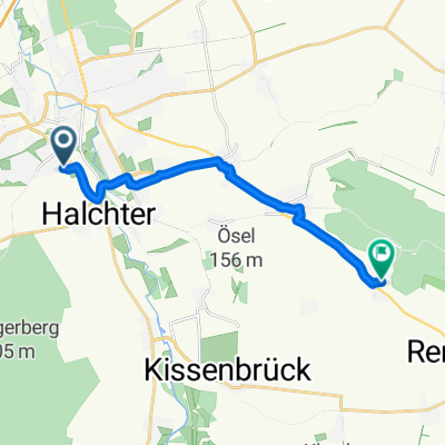
Wolfenbüttel - Wolfsburg Allersee
A cycling route starting in Wolfenbüttel, Lower Saxony, Germany.
Overview
About this route
None (cloned from route 686614)
(cloned from route 3129925)
- -:--
- Duration
- 94.8 km
- Distance
- 319 m
- Ascent
- 319 m
- Descent
- ---
- Avg. speed
- ---
- Max. altitude

Route quality
Waytypes & surfaces along the route
Waytypes
Track
28.5 km
(30 %)
Path
18 km
(19 %)
Surfaces
Paved
63.5 km
(67 %)
Unpaved
23.7 km
(25 %)
Asphalt
61.6 km
(65 %)
Gravel
14.2 km
(15 %)
Route highlights
Points of interest along the route
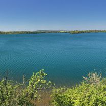
Point of interest after 3.6 km
Continue with Bikemap
Use, edit, or download this cycling route
You would like to ride Wolfenbüttel - Wolfsburg Allersee or customize it for your own trip? Here is what you can do with this Bikemap route:
Free features
- Save this route as favorite or in collections
- Copy & plan your own version of this route
- Split it into stages to create a multi-day tour
- Sync your route with Garmin or Wahoo
Premium features
Free trial for 3 days, or one-time payment. More about Bikemap Premium.
- Navigate this route on iOS & Android
- Export a GPX / KML file of this route
- Create your custom printout (try it for free)
- Download this route for offline navigation
Discover more Premium features.
Get Bikemap PremiumFrom our community
Other popular routes starting in Wolfenbüttel
 Asserunde_kurz
- Distance
- 36.8 km
- Ascent
- 331 m
- Descent
- 332 m
- Location
- Wolfenbüttel, Lower Saxony, Germany
 Lange Radrunde durch Wolfenbüttel
- Distance
- 42.7 km
- Ascent
- 55 m
- Descent
- 55 m
- Location
- Wolfenbüttel, Lower Saxony, Germany
 2019-01-05 WF-Sickte-Win-WF
- Distance
- 58.4 km
- Ascent
- 257 m
- Descent
- 255 m
- Location
- Wolfenbüttel, Lower Saxony, Germany
 Monplaisir, Wolfenbüttel nach Kastanienallee, Wittmar
- Distance
- 10.3 km
- Ascent
- 74 m
- Descent
- 20 m
- Location
- Wolfenbüttel, Lower Saxony, Germany
 Dorfstraße 9B, Wolfenbüttel to In den Äckern 17, Wolfenbüttel
- Distance
- 23.3 km
- Ascent
- 399 m
- Descent
- 399 m
- Location
- Wolfenbüttel, Lower Saxony, Germany
 Abseits der Via Romea
- Distance
- 35.5 km
- Ascent
- 42 m
- Descent
- 40 m
- Location
- Wolfenbüttel, Lower Saxony, Germany
 WF - Oderwald - Werla - Bornum - WF
- Distance
- 40.2 km
- Ascent
- 268 m
- Descent
- 268 m
- Location
- Wolfenbüttel, Lower Saxony, Germany
 Elmtour
- Distance
- 86.7 km
- Ascent
- 746 m
- Descent
- 760 m
- Location
- Wolfenbüttel, Lower Saxony, Germany
Open it in the app