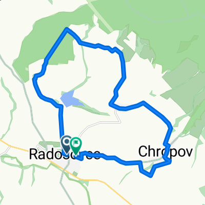
Mokroš radošovce
A cycling route starting in Skalica, Trnava Region, Slovakia.
Overview
About this route
Direction Skalica
- -:--
- Duration
- 42.2 km
- Distance
- 417 m
- Ascent
- 422 m
- Descent
- ---
- Avg. speed
- ---
- Max. altitude
Route quality
Waytypes & surfaces along the route
Waytypes
Road
27.8 km
(66 %)
Quiet road
5.1 km
(12 %)
Surfaces
Paved
26.6 km
(63 %)
Asphalt
26.6 km
(63 %)
Undefined
15.6 km
(37 %)
Continue with Bikemap
Use, edit, or download this cycling route
You would like to ride Mokroš radošovce or customize it for your own trip? Here is what you can do with this Bikemap route:
Free features
- Save this route as favorite or in collections
- Copy & plan your own version of this route
- Sync your route with Garmin or Wahoo
Premium features
Free trial for 3 days, or one-time payment. More about Bikemap Premium.
- Navigate this route on iOS & Android
- Export a GPX / KML file of this route
- Create your custom printout (try it for free)
- Download this route for offline navigation
Discover more Premium features.
Get Bikemap PremiumFrom our community
Other popular routes starting in Skalica
- TRDLOFEST 2024
- Distance
- 73.8 km
- Ascent
- 463 m
- Descent
- 462 m
- Location
- Skalica, Trnava Region, Slovakia
- Sporty route in Skalica
- Distance
- 67.9 km
- Ascent
- 1,505 m
- Descent
- 1,508 m
- Location
- Skalica, Trnava Region, Slovakia
- B08 Skalica - Cerova
- Distance
- 66.3 km
- Ascent
- 1,219 m
- Descent
- 1,169 m
- Location
- Skalica, Trnava Region, Slovakia
- Skalica - Prietržka - Hrebeň - Trnovec - Holíč - Vrádište - Skalica
- Distance
- 26.4 km
- Ascent
- 159 m
- Descent
- 161 m
- Location
- Skalica, Trnava Region, Slovakia
- turisticka
- Distance
- 190.6 km
- Ascent
- 1,232 m
- Descent
- 1,221 m
- Location
- Skalica, Trnava Region, Slovakia
- Skalica - Golfový klub - Skalické rybníky - Skalica
- Distance
- 9 km
- Ascent
- 38 m
- Descent
- 41 m
- Location
- Skalica, Trnava Region, Slovakia
- Skalica - Golfový klub - Prietržka - Trnovec - Holíč - Vrádište - Skalica
- Distance
- 18 km
- Ascent
- 119 m
- Descent
- 122 m
- Location
- Skalica, Trnava Region, Slovakia
- Skalica-Holič-Kopčany-Mikulčice-Lužice-Hodonin
- Distance
- 48.8 km
- Ascent
- 184 m
- Descent
- 181 m
- Location
- Skalica, Trnava Region, Slovakia
Open it in the app