

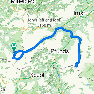
AC_Tag 2_1400Hm_120KM
A cycling route starting in Gaschurn, Vorarlberg, Austria.
Overview
About this route
2 Pässe
Alternative Pillertal- -:--
- Duration
- 120.5 km
- Distance
- 1,889 m
- Ascent
- 1,520 m
- Descent
- ---
- Avg. speed
- ---
- Max. altitude

Route quality
Waytypes & surfaces along the route
Waytypes
Quiet road
26.5 km
(22 %)
Track
13.3 km
(11 %)
Surfaces
Paved
110.9 km
(92 %)
Unpaved
4.8 km
(4 %)
Asphalt
110.9 km
(92 %)
Gravel
2.4 km
(2 %)
Continue with Bikemap
Use, edit, or download this cycling route
You would like to ride AC_Tag 2_1400Hm_120KM or customize it for your own trip? Here is what you can do with this Bikemap route:
Free features
- Save this route as favorite or in collections
- Copy & plan your own version of this route
- Split it into stages to create a multi-day tour
- Sync your route with Garmin or Wahoo
Premium features
Free trial for 3 days, or one-time payment. More about Bikemap Premium.
- Navigate this route on iOS & Android
- Export a GPX / KML file of this route
- Create your custom printout (try it for free)
- Download this route for offline navigation
Discover more Premium features.
Get Bikemap PremiumFrom our community
Other popular routes starting in Gaschurn
 Oetztaler-Form-Check
- Distance
- 234.9 km
- Ascent
- 4,064 m
- Descent
- 4,064 m
- Location
- Gaschurn, Vorarlberg, Austria
 Silvrettasee
- Distance
- 15.2 km
- Ascent
- 1,027 m
- Descent
- 18 m
- Location
- Gaschurn, Vorarlberg, Austria
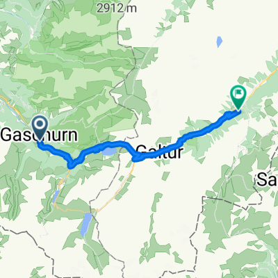
 T2 - Partenen - Landeck
- Distance
- 64.2 km
- Ascent
- 2,701 m
- Descent
- 2,956 m
- Location
- Gaschurn, Vorarlberg, Austria
 Alpen-X15 Tag 2
- Distance
- 31.6 km
- Ascent
- 2,571 m
- Descent
- 2,059 m
- Location
- Gaschurn, Vorarlberg, Austria
 Gaschurn - Ischgl
- Distance
- 29.7 km
- Ascent
- 1,349 m
- Descent
- 810 m
- Location
- Gaschurn, Vorarlberg, Austria
 AC_Tag 2_1400Hm_120KM
- Distance
- 120.5 km
- Ascent
- 1,889 m
- Descent
- 1,520 m
- Location
- Gaschurn, Vorarlberg, Austria
 Gaschurn-Gantenkopf-Gaschurn
- Distance
- 24.6 km
- Ascent
- 1,116 m
- Descent
- 1,116 m
- Location
- Gaschurn, Vorarlberg, Austria
 T2 - Partenen Mötz
- Distance
- 104.7 km
- Ascent
- 3,404 m
- Descent
- 3,783 m
- Location
- Gaschurn, Vorarlberg, Austria
Open it in the app