

Über den Höchsten den wir haben
A cycling route starting in Bruck an der Großglocknerstraße, Salzburg, Austria.
Overview
About this route
Großglockner up and down
- -:--
- Duration
- 48.5 km
- Distance
- 2,373 m
- Ascent
- 1,642 m
- Descent
- ---
- Avg. speed
- 2,527 m
- Max. altitude

Route quality
Waytypes & surfaces along the route
Waytypes
Road
47.6 km
(98 %)
Cycleway
0.5 km
(1 %)
Undefined
0.5 km
(1 %)
Surfaces
Paved
48.5 km
(100 %)
Asphalt
48.5 km
(100 %)
Continue with Bikemap
Use, edit, or download this cycling route
You would like to ride Über den Höchsten den wir haben or customize it for your own trip? Here is what you can do with this Bikemap route:
Free features
- Save this route as favorite or in collections
- Copy & plan your own version of this route
- Sync your route with Garmin or Wahoo
Premium features
Free trial for 3 days, or one-time payment. More about Bikemap Premium.
- Navigate this route on iOS & Android
- Export a GPX / KML file of this route
- Create your custom printout (try it for free)
- Download this route for offline navigation
Discover more Premium features.
Get Bikemap PremiumFrom our community
Other popular routes starting in Bruck an der Großglocknerstraße
 Über den Höchsten den wir haben
- Distance
- 48.5 km
- Ascent
- 2,373 m
- Descent
- 1,642 m
- Location
- Bruck an der Großglocknerstraße, Salzburg, Austria
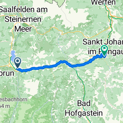 Von Bruck an der Großglocknerstraße bis Sankt Johann im Pongau
- Distance
- 37.6 km
- Ascent
- 944 m
- Descent
- 979 m
- Location
- Bruck an der Großglocknerstraße, Salzburg, Austria
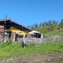 Heubergalm und zurück
- Distance
- 36.2 km
- Ascent
- 1,032 m
- Descent
- 1,073 m
- Location
- Bruck an der Großglocknerstraße, Salzburg, Austria
 Großglockner
- Distance
- 98.2 km
- Ascent
- 4,734 m
- Descent
- 4,733 m
- Location
- Bruck an der Großglocknerstraße, Salzburg, Austria
 Von Bruck an der Großglocknerstraße bis Dölsach
- Distance
- 83.1 km
- Ascent
- 3,175 m
- Descent
- 3,285 m
- Location
- Bruck an der Großglocknerstraße, Salzburg, Austria
 Glocknerkönig
- Distance
- 27.3 km
- Ascent
- 1,699 m
- Descent
- 222 m
- Location
- Bruck an der Großglocknerstraße, Salzburg, Austria
 Grossglockner and Edelweissspritze
- Distance
- 61.5 km
- Ascent
- 1,827 m
- Descent
- 1,825 m
- Location
- Bruck an der Großglocknerstraße, Salzburg, Austria
 Tour de Barcelona 2014 dzień 9
- Distance
- 87.1 km
- Ascent
- 2,338 m
- Descent
- 2,358 m
- Location
- Bruck an der Großglocknerstraße, Salzburg, Austria
Open it in the app