

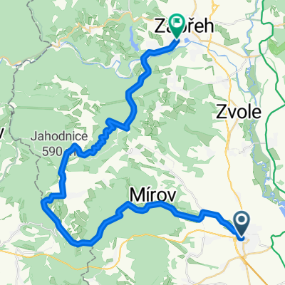
Mohelnice-Červená Voda-Jablonné-Č.Petrovice-Žamberk-Česká Třebová
A cycling route starting in Mohelnice, Olomoucký kraj, Czechia.
Overview
About this route
This was originally supposed to be a circular route through the Old Town of Moravská Třebová back to Mohelnice, but unfortunately the passing storm front decided that it would be more reasonable to use the Os3715 from Česká Třebová.
- -:--
- Duration
- 114.6 km
- Distance
- 1,528 m
- Ascent
- 1,459 m
- Descent
- ---
- Avg. speed
- 819 m
- Max. altitude
Route quality
Waytypes & surfaces along the route
Waytypes
Road
16 km
(14 %)
Quiet road
5.7 km
(5 %)
Surfaces
Paved
68.7 km
(60 %)
Asphalt
68.7 km
(60 %)
Undefined
45.8 km
(40 %)
Continue with Bikemap
Use, edit, or download this cycling route
You would like to ride Mohelnice-Červená Voda-Jablonné-Č.Petrovice-Žamberk-Česká Třebová or customize it for your own trip? Here is what you can do with this Bikemap route:
Free features
- Save this route as favorite or in collections
- Copy & plan your own version of this route
- Split it into stages to create a multi-day tour
- Sync your route with Garmin or Wahoo
Premium features
Free trial for 3 days, or one-time payment. More about Bikemap Premium.
- Navigate this route on iOS & Android
- Export a GPX / KML file of this route
- Create your custom printout (try it for free)
- Download this route for offline navigation
Discover more Premium features.
Get Bikemap PremiumFrom our community
Other popular routes starting in Mohelnice
 silnice - Mohelnice,Uničov,Libina,Špk.Lesnice,Zábřeh
- Distance
- 60.6 km
- Ascent
- 331 m
- Descent
- 323 m
- Location
- Mohelnice, Olomoucký kraj, Czechia
 mohelnice zábřeh
- Distance
- 32.9 km
- Ascent
- 335 m
- Descent
- 330 m
- Location
- Mohelnice, Olomoucký kraj, Czechia
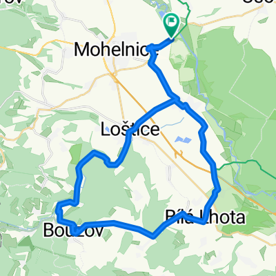
 Okolo Mírova 3
- Distance
- 57.5 km
- Ascent
- 767 m
- Descent
- 767 m
- Location
- Mohelnice, Olomoucký kraj, Czechia
 Mohelnice,Zábřeh,přes Háje aLeštinu po hrázi.
- Distance
- 19.7 km
- Ascent
- 60 m
- Descent
- 50 m
- Location
- Mohelnice, Olomoucký kraj, Czechia
 Mohelnice Maletín přes Střítež MTB
- Distance
- 28.4 km
- Ascent
- 532 m
- Descent
- 338 m
- Location
- Mohelnice, Olomoucký kraj, Czechia
 Mohelnice-Hanušovice-Ramzová-Jeseník-Rejvíz-Vrbno-Nové Heřmínovy-Bruntál-Skřítek-Šumperk-Mohelnice
- Distance
- 209.9 km
- Ascent
- 2,362 m
- Descent
- 2,361 m
- Location
- Mohelnice, Olomoucký kraj, Czechia
 Bouzov - kemp
- Distance
- 33.5 km
- Ascent
- 365 m
- Descent
- 366 m
- Location
- Mohelnice, Olomoucký kraj, Czechia
 Mohelnice-Červená Voda-Jablonné-Č.Petrovice-Žamberk-Česká Třebová
- Distance
- 114.6 km
- Ascent
- 1,528 m
- Descent
- 1,459 m
- Location
- Mohelnice, Olomoucký kraj, Czechia
Open it in the app