Massiv Alp 6: Lünersee- Sargans
A cycling route starting in Brand, Vorarlberg, Austria.
Overview
About this route
<span style="font-size: 11pt; font-weight: normal; font-family: "Calibri","sans-serif";"><<< Transalp von Ost nach West >>></span>
<span style="font-size: 11pt; font-weight: normal; font-family: "Calibri","sans-serif";">Zur<span style="mso-spacerun: yes;"> </span>sechsten Etappe</span> Vom Lünersee gehts zu Fuß zur Schweizer Grenze, dann Bergab über einen Trail. Später über einen Almweg, der schön zu fahren wäre, würde einem nich der Kuhdreck um die Ohren fliegen. Nach einem schiebe/tragestück bergauf (300hm) beginnt wieder ein gut fahrbarer Almweg der einen weiter bergauf führt. Danach geht es dafür satte 1500hm bergab. Im Rheintal angekommen führt die Etappe nach Sarganz. Die Etappe ist nur rellativ kurz, weil meine Bremsbeläge am Ende waren und ich mir neue besorgen musste. Die waren aber Sontags nicht zu bekommen. Dadurch musste ich schon Mittags, in Sarganz, meinen Radltag beenden.(cloned from route 1843558)
- -:--
- Duration
- 61.5 km
- Distance
- 1,750 m
- Ascent
- 3,233 m
- Descent
- ---
- Avg. speed
- ---
- Avg. speed
Route highlights
Points of interest along the route
Photo after 3 km
Grnze.
Photo after 3.5 km
Gegenüber geht es wieder bergauf.
Photo after 5.6 km
Scheiß Abfahrt. Im warsten Sinne des Wortes.
Photo after 15.7 km
So gehts wieder bergauf.
Photo after 21.3 km
Blick zurück.
Photo after 56.5 km
Übernacht im Waldkindergarten.
Drinking water after 57.7 km
Continue with Bikemap
Use, edit, or download this cycling route
You would like to ride Massiv Alp 6: Lünersee- Sargans or customize it for your own trip? Here is what you can do with this Bikemap route:
Free features
- Save this route as favorite or in collections
- Copy & plan your own version of this route
- Sync your route with Garmin or Wahoo
Premium features
Free trial for 3 days, or one-time payment. More about Bikemap Premium.
- Navigate this route on iOS & Android
- Export a GPX / KML file of this route
- Create your custom printout (try it for free)
- Download this route for offline navigation
Discover more Premium features.
Get Bikemap PremiumFrom our community
Other popular routes starting in Brand
- Brand-Oberzalimhütte,Brüggle Alpe
- Distance
- 13.1 km
- Ascent
- 884 m
- Descent
- 887 m
- Location
- Brand, Vorarlberg, Austria
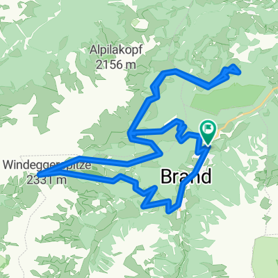
- Brand - Lötschkopf - 17 km - 350hm
- Distance
- 17.5 km
- Ascent
- 401 m
- Descent
- 1,253 m
- Location
- Brand, Vorarlberg, Austria
- Totalphütte - Lindauer Hüttte über Drusentor
- Distance
- 14.9 km
- Ascent
- 608 m
- Descent
- 1,248 m
- Location
- Brand, Vorarlberg, Austria
- Rundfahrt Brand 20km 1000HM
- Distance
- 25.3 km
- Ascent
- 996 m
- Descent
- 992 m
- Location
- Brand, Vorarlberg, Austria
- Brand,Parpfienzalpe, Furkaalpe, Frööd, Brand
- Distance
- 16.3 km
- Ascent
- 914 m
- Descent
- 374 m
- Location
- Brand, Vorarlberg, Austria
- Kleine Brandnertal-Runde | Brand-Bürserberg
- Distance
- 23.6 km
- Ascent
- 990 m
- Descent
- 990 m
- Location
- Brand, Vorarlberg, Austria
- Brand, Fuchsbau, Bürserberg
- Distance
- 26 km
- Ascent
- 1,050 m
- Descent
- 1,049 m
- Location
- Brand, Vorarlberg, Austria
- Brand Palüdhütte Rufana
- Distance
- 30.8 km
- Ascent
- 1,371 m
- Descent
- 1,382 m
- Location
- Brand, Vorarlberg, Austria
Open it in the app