

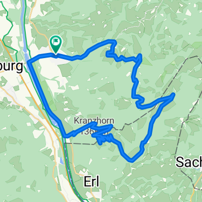
Ums Hochries / Trockenbachtal
A cycling route starting in Nußdorf am Inn, Bavaria, Germany.
Overview
About this route
From Nussdorf around the Hochries
- -:--
- Duration
- 35.5 km
- Distance
- 1,055 m
- Ascent
- 1,053 m
- Descent
- ---
- Avg. speed
- ---
- Max. altitude
Continue with Bikemap
Use, edit, or download this cycling route
You would like to ride Ums Hochries / Trockenbachtal or customize it for your own trip? Here is what you can do with this Bikemap route:
Free features
- Save this route as favorite or in collections
- Copy & plan your own version of this route
- Sync your route with Garmin or Wahoo
Premium features
Free trial for 3 days, or one-time payment. More about Bikemap Premium.
- Navigate this route on iOS & Android
- Export a GPX / KML file of this route
- Create your custom printout (try it for free)
- Download this route for offline navigation
Discover more Premium features.
Get Bikemap PremiumFrom our community
Other popular routes starting in Nußdorf am Inn
 Feichteck mit Supertrail
- Distance
- 22.6 km
- Ascent
- 1,101 m
- Descent
- 1,107 m
- Location
- Nußdorf am Inn, Bavaria, Germany
 Hochries
- Distance
- 35.9 km
- Ascent
- 1,022 m
- Descent
- 1,022 m
- Location
- Nußdorf am Inn, Bavaria, Germany
 Route nach ¿ˇÖ??
- Distance
- 13.7 km
- Ascent
- 6 m
- Descent
- 18 m
- Location
- Nußdorf am Inn, Bavaria, Germany
 Heuberg - Klassiker
- Distance
- 9.6 km
- Ascent
- 609 m
- Descent
- 610 m
- Location
- Nußdorf am Inn, Bavaria, Germany
 Feichteck von Nußdorf am Inn
- Distance
- 27.8 km
- Ascent
- 1,114 m
- Descent
- 1,114 m
- Location
- Nußdorf am Inn, Bavaria, Germany
 Zifferalm-Runde Wanderung
- Distance
- 7.1 km
- Ascent
- 374 m
- Descent
- 371 m
- Location
- Nußdorf am Inn, Bavaria, Germany
 Radtour am 15.07.2018
- Distance
- 51.6 km
- Ascent
- 65 m
- Descent
- 65 m
- Location
- Nußdorf am Inn, Bavaria, Germany
 Bike 03 Kranzhorn
- Distance
- 35.1 km
- Ascent
- 975 m
- Descent
- 979 m
- Location
- Nußdorf am Inn, Bavaria, Germany
Open it in the app