

Sengersberg Trail
A cycling route starting in Bad Salzschlirf, Hesse, Germany.
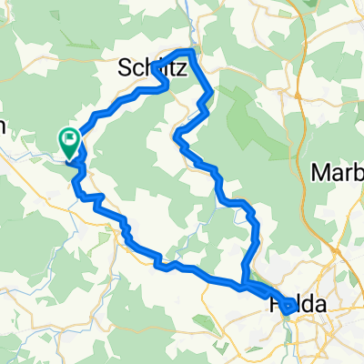
Overview
About this route
Starting point at the summit cross above the quarry. Follow the markers 700 m northwest over the highest point of the Sengersberg, the Grafengunst (498 m), to the basalt rock. From there, veer slightly right on a worn path through the forest to the edge of the woods between Bad-Salzschlirf and Ützhausen (approx. 200 m altitude difference).
Special note: Riding the trail at your own risk!!!!!
- -:--
- Duration
- 2.4 km
- Distance
- 72 m
- Ascent
- 242 m
- Descent
- ---
- Avg. speed
- ---
- Max. altitude

Continue with Bikemap
Use, edit, or download this cycling route
You would like to ride Sengersberg Trail or customize it for your own trip? Here is what you can do with this Bikemap route:
Free features
- Save this route as favorite or in collections
- Copy & plan your own version of this route
- Sync your route with Garmin or Wahoo
Premium features
Free trial for 3 days, or one-time payment. More about Bikemap Premium.
- Navigate this route on iOS & Android
- Export a GPX / KML file of this route
- Create your custom printout (try it for free)
- Download this route for offline navigation
Discover more Premium features.
Get Bikemap PremiumFrom our community
Other popular routes starting in Bad Salzschlirf
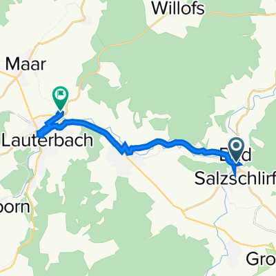 Schmittstraße 1, Bad Salzschlirf to Lauterbach (Hessen) Nordbahnhof
- Distance
- 11.2 km
- Ascent
- 114 m
- Descent
- 77 m
- Location
- Bad Salzschlirf, Hesse, Germany
 Kindertour 4 bis Friedlos
- Distance
- 48.6 km
- Ascent
- 106 m
- Descent
- 143 m
- Location
- Bad Salzschlirf, Hesse, Germany
 Landenhausen_Hahn
- Distance
- 144.8 km
- Ascent
- 585 m
- Descent
- 769 m
- Location
- Bad Salzschlirf, Hesse, Germany
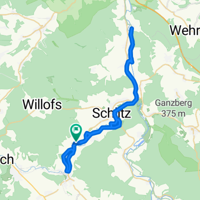 Lange Ausfahrt durch Schlitz
- Distance
- 38 km
- Ascent
- 194 m
- Descent
- 197 m
- Location
- Bad Salzschlirf, Hesse, Germany
 Skiroute_Landenhausen
- Distance
- 0.4 km
- Ascent
- 0 m
- Descent
- 50 m
- Location
- Bad Salzschlirf, Hesse, Germany
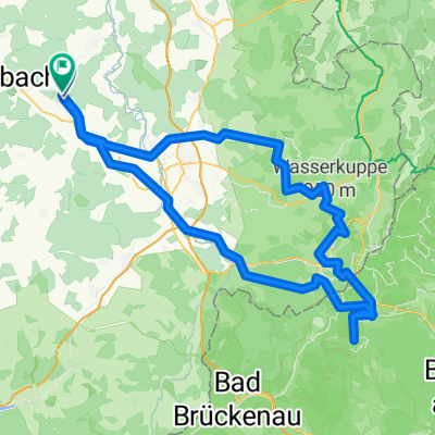 Bd Salzschlirf, Wasserkuppe, Kreuzberg
- Distance
- 135 km
- Ascent
- 1,819 m
- Descent
- 1,852 m
- Location
- Bad Salzschlirf, Hesse, Germany
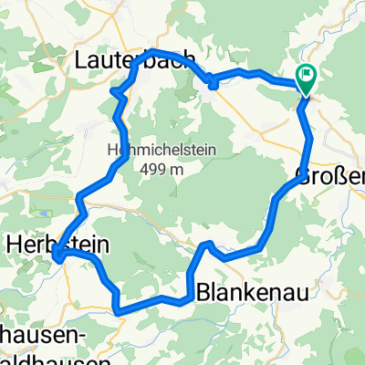 Vogelsberg-Vulkanradweg CLONED FROM ROUTE 155085
- Distance
- 45 km
- Ascent
- 441 m
- Descent
- 415 m
- Location
- Bad Salzschlirf, Hesse, Germany
 Route in Bad Salzschlirf
- Distance
- 55 km
- Ascent
- 540 m
- Descent
- 541 m
- Location
- Bad Salzschlirf, Hesse, Germany
Open it in the app