Unterampfrach-Güglingen
- 133.5 km
- 563 m
- 805 m
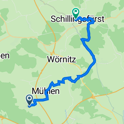
- Schnelldorf, Bavaria, Germany
A cycling route starting in Schnelldorf, Bavaria, Germany.
Overview
The bike path passes by the Maulach beer garden and leads to the Burgberg viewpoint. The last steep section to Burgberg should be walked as it is a hiking trail. After a wonderful panoramic view from the Burgberg tower, the route descends to Onolzheim. Passing the water tower, it continues into the town center of Crailsheim, then returns to Ellrichshausen via Beuerlbach.
created this 16 years ago
Route quality
Track
21.5 km
(48 %)
Quiet road
15.3 km
(34 %)
Paved
27.8 km
(62 %)
Unpaved
5.8 km
(13 %)
Asphalt
18.8 km
(42 %)
Paved (undefined)
9 km
(20 %)
Continue with Bikemap
You would like to ride Ellrichshausen Burgberg or customize it for your own trip? Here is what you can do with this Bikemap route:
Free trial for 3 days, or one-time payment. More about Bikemap Premium.
Discover more Premium features.
Get Bikemap PremiumFrom our community
Open it in the app