

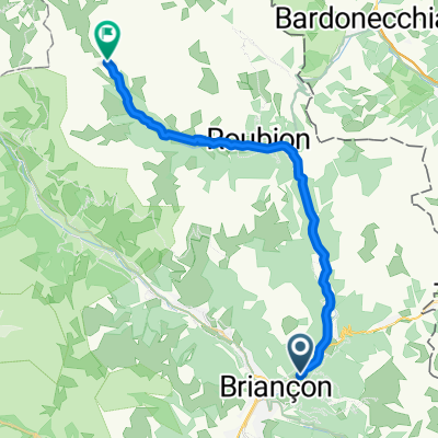
briançon - galibier - télégraphe - croix de fer - glandon
A cycling route starting in Briançon, Provence-Alpes-Côte d'Azur Region, France.
Overview
About this route
briançon - grenoble par les grands cols (esquive du chambon)
- -:--
- Duration
- 146.4 km
- Distance
- 3,192 m
- Ascent
- 3,679 m
- Descent
- ---
- Avg. speed
- ---
- Max. altitude

Route quality
Waytypes & surfaces along the route
Waytypes
Quiet road
16.1 km
(11 %)
Track
7.3 km
(5 %)
Surfaces
Paved
92.2 km
(63 %)
Unpaved
5.9 km
(4 %)
Asphalt
92.2 km
(63 %)
Ground
4.4 km
(3 %)
Continue with Bikemap
Use, edit, or download this cycling route
You would like to ride briançon - galibier - télégraphe - croix de fer - glandon or customize it for your own trip? Here is what you can do with this Bikemap route:
Free features
- Save this route as favorite or in collections
- Copy & plan your own version of this route
- Split it into stages to create a multi-day tour
- Sync your route with Garmin or Wahoo
Premium features
Free trial for 3 days, or one-time payment. More about Bikemap Premium.
- Navigate this route on iOS & Android
- Export a GPX / KML file of this route
- Create your custom printout (try it for free)
- Download this route for offline navigation
Discover more Premium features.
Get Bikemap PremiumFrom our community
Other popular routes starting in Briançon
 Francia Alpok 09 vándor
- Distance
- 69.8 km
- Ascent
- 824 m
- Descent
- 1,464 m
- Location
- Briançon, Provence-Alpes-Côte d'Azur Region, France
 Col de l'Echelle
- Distance
- 20.5 km
- Ascent
- 546 m
- Descent
- 69 m
- Location
- Briançon, Provence-Alpes-Côte d'Azur Region, France
 Izoard
- Distance
- 83.4 km
- Ascent
- 1,566 m
- Descent
- 1,566 m
- Location
- Briançon, Provence-Alpes-Côte d'Azur Region, France
 briancon-izoard
- Distance
- 20.4 km
- Ascent
- 1,201 m
- Descent
- 155 m
- Location
- Briançon, Provence-Alpes-Côte d'Azur Region, France
 2013-07-20: Briançon - St-Michel-de-Maurienne
- Distance
- 77.2 km
- Ascent
- 1,464 m
- Descent
- 2,104 m
- Location
- Briançon, Provence-Alpes-Côte d'Azur Region, France
 01_Val-des-Prés bis Névache 30/900
- Distance
- 28 km
- Ascent
- 889 m
- Descent
- 141 m
- Location
- Briançon, Provence-Alpes-Côte d'Azur Region, France
 Izoard - Agnel + Izoard
- Distance
- 140 km
- Ascent
- 2,927 m
- Descent
- 2,931 m
- Location
- Briançon, Provence-Alpes-Côte d'Azur Region, France
 Col du Galibier via the old road
- Distance
- 52 km
- Ascent
- 1,387 m
- Descent
- 1,239 m
- Location
- Briançon, Provence-Alpes-Côte d'Azur Region, France
Open it in the app