
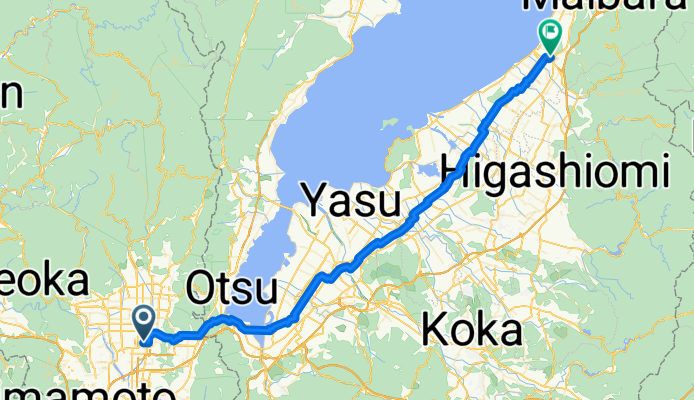
0820京都-彥根70km
A cycling route starting in Kyoto, Kyoto, Japan.
Overview
About this route
琵琶湖沿岸
安土城 觀音寺城跡 彥根城 國1-18-559-2 露宿-彥根城公園- -:--
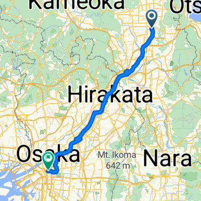
- Duration
- 70.2 km
- Distance
- 267 m
- Ascent
- 203 m
- Descent
- ---
- Avg. speed
- ---
- Max. altitude
Route highlights
Points of interest along the route
Point of interest after 50.2 km
総見寺
Continue with Bikemap
Use, edit, or download this cycling route
You would like to ride 0820京都-彥根70km or customize it for your own trip? Here is what you can do with this Bikemap route:
Free features
- Save this route as favorite or in collections
- Copy & plan your own version of this route
- Sync your route with Garmin or Wahoo
Premium features
Free trial for 3 days, or one-time payment. More about Bikemap Premium.
- Navigate this route on iOS & Android
- Export a GPX / KML file of this route
- Create your custom printout (try it for free)
- Download this route for offline navigation
Discover more Premium features.
Get Bikemap PremiumFrom our community
Other popular routes starting in Kyoto
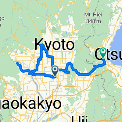
 Nishikyogoku-Otsu
- Distance
- 25.5 km
- Ascent
- 260 m
- Descent
- 205 m
- Location
- Kyoto, Kyoto, Japan
 Kyoto to Osaka
- Distance
- 56.3 km
- Ascent
- 241 m
- Descent
- 268 m
- Location
- Kyoto, Kyoto, Japan
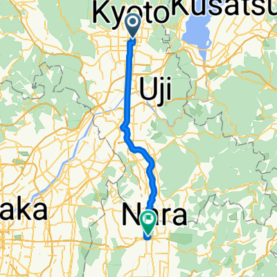
 Kyoto-Nara-Osaka
- Distance
- 76.9 km
- Ascent
- 570 m
- Descent
- 596 m
- Location
- Kyoto, Kyoto, Japan
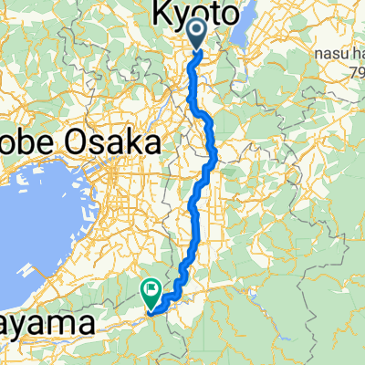
 kyoto to nara
- Distance
- 44.6 km
- Ascent
- 121 m
- Descent
- 103 m
- Location
- Kyoto, Kyoto, Japan
 White Boddha
- Distance
- 21.1 km
- Ascent
- 61 m
- Descent
- 80 m
- Location
- Kyoto, Kyoto, Japan
 東塩小路町, 京都市へ御陵町, 大津市
- Distance
- 46.6 km
- Ascent
- 505 m
- Descent
- 451 m
- Location
- Kyoto, Kyoto, Japan
 Kyoto - Tawaramoto
- Distance
- 104.3 km
- Ascent
- 867 m
- Descent
- 767 m
- Location
- Kyoto, Kyoto, Japan
 kyoto to osaka
- Distance
- 53.5 km
- Ascent
- 229 m
- Descent
- 242 m
- Location
- Kyoto, Kyoto, Japan
Open it in the app