

0821彥根-長濱51km
A cycling route starting in Hikone, Shiga Prefecture, Japan.
Overview
About this route
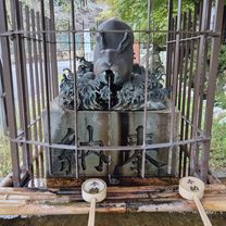
彥根城
關原古戰場 小谷城跡 192m/6km(3%) 國21-國365 露宿-小谷城史蹟館- -:--
- Duration
- 51.5 km
- Distance
- 422 m
- Ascent
- 412 m
- Descent
- ---
- Avg. speed
- ---
- Max. altitude
Continue with Bikemap
Use, edit, or download this cycling route
You would like to ride 0821彥根-長濱51km or customize it for your own trip? Here is what you can do with this Bikemap route:
Free features
- Save this route as favorite or in collections
- Copy & plan your own version of this route
- Sync your route with Garmin or Wahoo
Premium features
Free trial for 3 days, or one-time payment. More about Bikemap Premium.
- Navigate this route on iOS & Android
- Export a GPX / KML file of this route
- Create your custom printout (try it for free)
- Download this route for offline navigation
Discover more Premium features.
Get Bikemap PremiumFrom our community
Other popular routes starting in Hikone
 ボームベース
- Distance
- 73.1 km
- Ascent
- 232 m
- Descent
- 423 m
- Location
- Hikone, Shiga Prefecture, Japan
 Route to Otsu
- Distance
- 75.8 km
- Ascent
- 470 m
- Descent
- 458 m
- Location
- Hikone, Shiga Prefecture, Japan
 2016Tour-Hikone-Gifu
- Distance
- 60 km
- Ascent
- 211 m
- Descent
- 291 m
- Location
- Hikone, Shiga Prefecture, Japan
 高宮町701-1, 彦根市 to 在士809, 犬上郡甲良町
- Distance
- 4.2 km
- Ascent
- 19 m
- Descent
- 13 m
- Location
- Hikone, Shiga Prefecture, Japan
 Hikone - Tsuruga
- Distance
- 66.7 km
- Ascent
- 298 m
- Descent
- 376 m
- Location
- Hikone, Shiga Prefecture, Japan
 高宮町701-1, 彦根市 to 尼子1422, 犬上郡甲良町
- Distance
- 5.6 km
- Ascent
- 11 m
- Descent
- 4 m
- Location
- Hikone, Shiga Prefecture, Japan
 0821彥根-長濱51km
- Distance
- 51.5 km
- Ascent
- 422 m
- Descent
- 412 m
- Location
- Hikone, Shiga Prefecture, Japan
 09-06-2013_Day03
- Distance
- 67.4 km
- Ascent
- 253 m
- Descent
- 310 m
- Location
- Hikone, Shiga Prefecture, Japan
Open it in the app