

2015_FR_90 km_2000 hm
A cycling route starting in Saint-Chinian, Occitanie, France.
Overview
About this route
2015, France, 90 km and over 2000 m of elevation
- -:--
- Duration
- 93.8 km
- Distance
- 1,561 m
- Ascent
- 1,564 m
- Descent
- ---
- Avg. speed
- ---
- Max. altitude
Route quality
Waytypes & surfaces along the route
Waytypes
Road
55.3 km
(59 %)
Track
5.6 km
(6 %)
Surfaces
Paved
4.7 km
(5 %)
Unpaved
5.6 km
(6 %)
Gravel
5.6 km
(6 %)
Asphalt
4.7 km
(5 %)
Undefined
83.4 km
(89 %)
Continue with Bikemap
Use, edit, or download this cycling route
You would like to ride 2015_FR_90 km_2000 hm or customize it for your own trip? Here is what you can do with this Bikemap route:
Free features
- Save this route as favorite or in collections
- Copy & plan your own version of this route
- Split it into stages to create a multi-day tour
- Sync your route with Garmin or Wahoo
Premium features
Free trial for 3 days, or one-time payment. More about Bikemap Premium.
- Navigate this route on iOS & Android
- Export a GPX / KML file of this route
- Create your custom printout (try it for free)
- Download this route for offline navigation
Discover more Premium features.
Get Bikemap PremiumFrom our community
Other popular routes starting in Saint-Chinian
 19 Route de Cessenon, Prades-sur-Vernazobre à 27 Route de Cessenon, Prades-sur-Vernazobre
- Distance
- 7.2 km
- Ascent
- 65 m
- Descent
- 72 m
- Location
- Saint-Chinian, Occitanie, France
 Col de Fontfroide 127 km
- Distance
- 126.7 km
- Ascent
- 1,890 m
- Descent
- 1,890 m
- Location
- Saint-Chinian, Occitanie, France
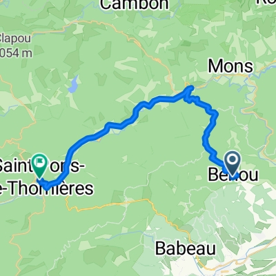 Route to Saint-Pons-de-Thomières
- Distance
- 31.5 km
- Ascent
- 1,183 m
- Descent
- 1,074 m
- Location
- Saint-Chinian, Occitanie, France
 saint chinian col de tremoulis
- Distance
- 31.9 km
- Ascent
- 577 m
- Descent
- 534 m
- Location
- Saint-Chinian, Occitanie, France
 Prades-sur-Vernazobre - Berlou - Mézilles - Ceps - Roquebrun - Cessenon-sur-Orb - Prades-sur-Vernazobre
- Distance
- 38.1 km
- Ascent
- 542 m
- Descent
- 543 m
- Location
- Saint-Chinian, Occitanie, France
 St.Chinian-Lodève-Ganges
- Distance
- 129.3 km
- Ascent
- 1,084 m
- Descent
- 1,051 m
- Location
- Saint-Chinian, Occitanie, France
 Prades-sur-Vernazobre - Saint-Chinian -Cébazan - Cessenon-sur-Orb - Prades-sur-Vernazobre
- Distance
- 46.1 km
- Ascent
- 468 m
- Descent
- 469 m
- Location
- Saint-Chinian, Occitanie, France
 2015_FR_90 km_2000 hm
- Distance
- 93.8 km
- Ascent
- 1,561 m
- Descent
- 1,564 m
- Location
- Saint-Chinian, Occitanie, France
Open it in the app