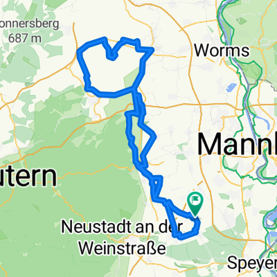
Rund um den Böhler Wasserturm - Böhl-Iggelheim
A cycling route starting in Böhl-Iggelheim, Rhineland-Palatinate, Germany.
Overview
About this route
Rund um den Böhler Wasserturm - Böhl-Iggelheim
- -:--
- Duration
- 0.9 km
- Distance
- 0 m
- Ascent
- 0 m
- Descent
- ---
- Avg. speed
- ---
- Avg. speed
Route quality
Waytypes & surfaces along the route
Waytypes
Quiet road
0.9 km
(100 %)
Surfaces
Paved
0.9 km
(100 %)
Asphalt
0.9 km
(100 %)
Continue with Bikemap
Use, edit, or download this cycling route
You would like to ride Rund um den Böhler Wasserturm - Böhl-Iggelheim or customize it for your own trip? Here is what you can do with this Bikemap route:
Free features
- Save this route as favorite or in collections
- Copy & plan your own version of this route
- Sync your route with Garmin or Wahoo
Premium features
Free trial for 3 days, or one-time payment. More about Bikemap Premium.
- Navigate this route on iOS & Android
- Export a GPX / KML file of this route
- Create your custom printout (try it for free)
- Download this route for offline navigation
Discover more Premium features.
Get Bikemap PremiumFrom our community
Other popular routes starting in Böhl-Iggelheim
- Vorderpfalztour
- Distance
- 79.1 km
- Ascent
- 511 m
- Descent
- 515 m
- Location
- Böhl-Iggelheim, Rhineland-Palatinate, Germany
- Durch Täler über Höhen 2020 - RTF der RC Vorwärts 1901 Böhl-Iggelheim e.V. - 159 km Strecke
- Distance
- 159.8 km
- Ascent
- 3,126 m
- Descent
- 3,117 m
- Location
- Böhl-Iggelheim, Rhineland-Palatinate, Germany
- Kraft am Berg
- Distance
- 75.5 km
- Ascent
- 1,566 m
- Descent
- 1,549 m
- Location
- Böhl-Iggelheim, Rhineland-Palatinate, Germany
- Rund um den Böhler Wasserturm - Böhl-Iggelheim
- Distance
- 0.9 km
- Ascent
- 0 m
- Descent
- 0 m
- Location
- Böhl-Iggelheim, Rhineland-Palatinate, Germany
- Flache Hügel
- Distance
- 104.5 km
- Ascent
- 523 m
- Descent
- 517 m
- Location
- Böhl-Iggelheim, Rhineland-Palatinate, Germany
- Vorderpfalztour
- Distance
- 82.5 km
- Ascent
- 489 m
- Descent
- 492 m
- Location
- Böhl-Iggelheim, Rhineland-Palatinate, Germany
- Rheindamm
- Distance
- 47 km
- Ascent
- 47 m
- Descent
- 53 m
- Location
- Böhl-Iggelheim, Rhineland-Palatinate, Germany
- Böhl-Iggelheim - Wahagnies 1. Etappe
- Distance
- 157.5 km
- Ascent
- 433 m
- Descent
- 302 m
- Location
- Böhl-Iggelheim, Rhineland-Palatinate, Germany