

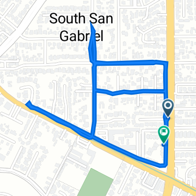
#GOONSQUAD GAUNTLET
A cycling route starting in South San Gabriel, California, United States.
Overview
About this route
PREPARE YOUR ANUS. 15 1/2 miles of deadly hills, 300+ foot climbs, crazy Asian drivers, and roads full of potholes. I made some sinister additions to the orignal #GOONSQUAD ride. No sightseeing this time. EXPECT THIS RIDE TO TAKE ABOUT 2 HOURS BRAKES/ EXTREMELY GOOD SKIDDING SKILLS NEEDED. CLIPLESS/TOE CLIPS RECOMMENDED. LIGHTS AND HELMETS REQUIRED. DO NOT BRING ANYTHING BESIDES A WATER BOTTLE.
RIDE DESCRIPTION: In addition to the OG route, riders now have to climb deadly Wilcox Ave to Schurr HS, and bomb back down the other side of the school. Riders will then have to cross Potrero Grande to Markland. Markland to Riggin, then to Garfield Ave. The route takes us back up Doncrest, and then the ride proceeds up to the dreaded Brightwood Ave. BE VERY CAREFUL, BECAUSE THIS STREET IS STEEP AS HELL. After conquering Brightwood, riders will then have to go up Monterey Pass Road back to Garvey, then following the original route back to Starbucks/Taco truck.- -:--
- Duration
- 25.3 km
- Distance
- 209 m
- Ascent
- 182 m
- Descent
- ---
- Avg. speed
- ---
- Max. altitude
Route quality
Waytypes & surfaces along the route
Waytypes
Road
12.4 km
(49 %)
Quiet road
6.3 km
(25 %)
Surfaces
Paved
9.9 km
(39 %)
Asphalt
9.9 km
(39 %)
Undefined
15.4 km
(61 %)
Continue with Bikemap
Use, edit, or download this cycling route
You would like to ride #GOONSQUAD GAUNTLET or customize it for your own trip? Here is what you can do with this Bikemap route:
Free features
- Save this route as favorite or in collections
- Copy & plan your own version of this route
- Sync your route with Garmin or Wahoo
Premium features
Free trial for 3 days, or one-time payment. More about Bikemap Premium.
- Navigate this route on iOS & Android
- Export a GPX / KML file of this route
- Create your custom printout (try it for free)
- Download this route for offline navigation
Discover more Premium features.
Get Bikemap PremiumFrom our community
Other popular routes starting in South San Gabriel
 2727 Pellissier Pl City Of Industry, CA 90601 美国
- Distance
- 0.3 km
- Ascent
- 16 m
- Descent
- 0 m
- Location
- South San Gabriel, California, United States
 #GOONSQUAD GAUNTLET
- Distance
- 25.3 km
- Ascent
- 209 m
- Descent
- 182 m
- Location
- South San Gabriel, California, United States
 Recovered Route
- Distance
- 6.2 km
- Ascent
- 42 m
- Descent
- 58 m
- Location
- South San Gabriel, California, United States
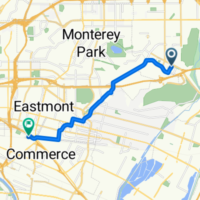 1151 San Gabriel Blvd, Rosemead to 5116 Triggs St, Commerce
- Distance
- 9.8 km
- Ascent
- 75 m
- Descent
- 126 m
- Location
- South San Gabriel, California, United States
 Upper Rio Hondo, Rosemead to 1701 Santa Anita Ave, South El Monte
- Distance
- 10.2 km
- Ascent
- 89 m
- Descent
- 82 m
- Location
- South San Gabriel, California, United States
 pub crawl Rosemead /SGV
- Distance
- 16.4 km
- Ascent
- 63 m
- Descent
- 22 m
- Location
- South San Gabriel, California, United States
 8135 Wagon Wheel Ct, Rosemead to 1445 San Gabriel Blvd, Rosemead
- Distance
- 3 km
- Ascent
- 23 m
- Descent
- 25 m
- Location
- South San Gabriel, California, United States
 Route #1
- Distance
- 17.8 km
- Ascent
- 224 m
- Descent
- 95 m
- Location
- South San Gabriel, California, United States
Open it in the app