

Lama di Reno - Lago di Suviana
A cycling route starting in Marzabotto, Emilia-Romagna, Italy.
Overview
About this route
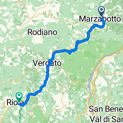
Dalla Stazione FS ciclabili e strade secondarie fino a Carbona di Vergato. Breve tratto di Statale. Prima della galleria direzione Riola e poi al passaggio a livello Suviana. Rientro possibile anche con treno da Riola di Vergato.
- -:--
- Duration
- 44.6 km
- Distance
- 618 m
- Ascent
- 259 m
- Descent
- ---
- Avg. speed
- ---
- Max. altitude

Continue with Bikemap
Use, edit, or download this cycling route
You would like to ride Lama di Reno - Lago di Suviana or customize it for your own trip? Here is what you can do with this Bikemap route:
Free features
- Save this route as favorite or in collections
- Copy & plan your own version of this route
- Sync your route with Garmin or Wahoo
Premium features
Free trial for 3 days, or one-time payment. More about Bikemap Premium.
- Navigate this route on iOS & Android
- Export a GPX / KML file of this route
- Create your custom printout (try it for free)
- Download this route for offline navigation
Discover more Premium features.
Get Bikemap PremiumFrom our community
Other popular routes starting in Marzabotto
 EV7 Marzabotto - Riola
- Distance
- 23.9 km
- Ascent
- 381 m
- Descent
- 251 m
- Location
- Marzabotto, Emilia-Romagna, Italy
 Monte Vignola cross 1
- Distance
- 23.2 km
- Ascent
- 572 m
- Descent
- 584 m
- Location
- Marzabotto, Emilia-Romagna, Italy
 Vezedelo 2
- Distance
- 15.4 km
- Ascent
- 598 m
- Descent
- 607 m
- Location
- Marzabotto, Emilia-Romagna, Italy
 Giro attorno a Monte Sole
- Distance
- 36.3 km
- Ascent
- 1,134 m
- Descent
- 1,095 m
- Location
- Marzabotto, Emilia-Romagna, Italy
 bestemmie a monte sole
- Distance
- 17.2 km
- Ascent
- 1,157 m
- Descent
- 898 m
- Location
- Marzabotto, Emilia-Romagna, Italy
 e) 10 BO Ciclovia della Memoria, Parco storico regionale di Monte Sole (BO)
- Distance
- 26 km
- Ascent
- 852 m
- Descent
- 854 m
- Location
- Marzabotto, Emilia-Romagna, Italy
 Vignola part
- Distance
- 16.8 km
- Ascent
- 641 m
- Descent
- 411 m
- Location
- Marzabotto, Emilia-Romagna, Italy
 Pian di Venola "Il Cane"
- Distance
- 29.4 km
- Ascent
- 764 m
- Descent
- 764 m
- Location
- Marzabotto, Emilia-Romagna, Italy
Open it in the app