

Sugar Creek - The Hub
A cycling route starting in Des Peres, Missouri, United States.
Overview
About this route
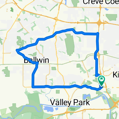
Sugar Creek - The Hub
- -:--
- Duration
- 10.1 km
- Distance
- 105 m
- Ascent
- 76 m
- Descent
- ---
- Avg. speed
- ---
- Max. altitude
Route quality
Waytypes & surfaces along the route
Waytypes
Quiet road
2.1 km
(21 %)
Access road
0.5 km
(5 %)
Surfaces
Paved
4.3 km
(43 %)
Asphalt
2.9 km
(29 %)
Concrete
1.4 km
(14 %)
Undefined
5.7 km
(57 %)
Continue with Bikemap
Use, edit, or download this cycling route
You would like to ride Sugar Creek - The Hub or customize it for your own trip? Here is what you can do with this Bikemap route:
Free features
- Save this route as favorite or in collections
- Copy & plan your own version of this route
- Sync your route with Garmin or Wahoo
Premium features
Free trial for 3 days, or one-time payment. More about Bikemap Premium.
- Navigate this route on iOS & Android
- Export a GPX / KML file of this route
- Create your custom printout (try it for free)
- Download this route for offline navigation
Discover more Premium features.
Get Bikemap PremiumFrom our community
Other popular routes starting in Des Peres
 Kirkwood - Webster loop
- Distance
- 26.4 km
- Ascent
- 168 m
- Descent
- 168 m
- Location
- Des Peres, Missouri, United States
 Greenbriar to Kers Mill and back
- Distance
- 34 km
- Ascent
- 224 m
- Descent
- 224 m
- Location
- Des Peres, Missouri, United States
 Kirkwood - North DesPeres
- Distance
- 25.9 km
- Ascent
- 240 m
- Descent
- 241 m
- Location
- Des Peres, Missouri, United States
 Blistering ride in Kirkwood
- Distance
- 48.6 km
- Ascent
- 291 m
- Descent
- 295 m
- Location
- Des Peres, Missouri, United States
 Greenbriar to Clayton/Clarkson to Castlewood and back
- Distance
- 40.6 km
- Ascent
- 307 m
- Descent
- 308 m
- Location
- Des Peres, Missouri, United States
 1533 Breezeridge Dr, Des Peres to 13922 Manchester Rd, Ballwin
- Distance
- 6.8 km
- Ascent
- 27 m
- Descent
- 77 m
- Location
- Des Peres, Missouri, United States
 Greenbriar to Missouri River to Meramec River and Back
- Distance
- 82.8 km
- Ascent
- 374 m
- Descent
- 375 m
- Location
- Des Peres, Missouri, United States
 214 Lindeman Rd, Kirkwood to 214 Lindeman Rd, Kirkwood
- Distance
- 21.9 km
- Ascent
- 254 m
- Descent
- 253 m
- Location
- Des Peres, Missouri, United States
Open it in the app