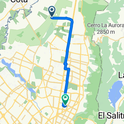
Etapa 1
A cycling route starting in Cota, Cundinamarca, Colombia.
Overview
About this route
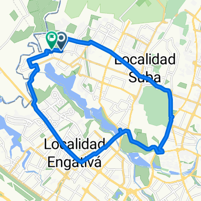
Vuelta a Colombia 2015
- -:--
- Duration
- 25.8 km
- Distance
- 52 m
- Ascent
- 55 m
- Descent
- ---
- Avg. speed
- ---
- Max. altitude
Route quality
Waytypes & surfaces along the route
Waytypes
Cycleway
17 km
(66 %)
Quiet road
4 km
(16 %)
Surfaces
Paved
14.5 km
(56 %)
Asphalt
12.8 km
(50 %)
Paved (undefined)
1.4 km
(5 %)
Continue with Bikemap
Use, edit, or download this cycling route
You would like to ride Etapa 1 or customize it for your own trip? Here is what you can do with this Bikemap route:
Free features
- Save this route as favorite or in collections
- Copy & plan your own version of this route
- Sync your route with Garmin or Wahoo
Premium features
Free trial for 3 days, or one-time payment. More about Bikemap Premium.
- Navigate this route on iOS & Android
- Export a GPX / KML file of this route
- Create your custom printout (try it for free)
- Download this route for offline navigation
Discover more Premium features.
Get Bikemap PremiumFrom our community
Other popular routes starting in Cota
- De Bogotá ‎-La Caro 18343 a Carrera 159 136-59, Bogotá
- Distance
- 19.6 km
- Ascent
- 0 m
- Descent
- 12 m
- Location
- Cota, Cundinamarca, Colombia
- De Carrera 16 6, Bogotá a Carrera 16 6, Bogotá
- Distance
- 12.8 km
- Ascent
- 45 m
- Descent
- 48 m
- Location
- Cota, Cundinamarca, Colombia
- Bogotá - Santa Marta - Valledupar - Bucaramanga - Bogotá
- Distance
- 2,131.1 km
- Ascent
- 4,580 m
- Descent
- 4,570 m
- Location
- Cota, Cundinamarca, Colombia
- Polideportivo Ciudadela Colsubsidio
- Distance
- 9.3 km
- Ascent
- 45 m
- Descent
- 52 m
- Location
- Cota, Cundinamarca, Colombia
- Suba a Zipaquirá
- Distance
- 40.5 km
- Ascent
- 1,072 m
- Descent
- 1,014 m
- Location
- Cota, Cundinamarca, Colombia
- cota cundinamarca
- Distance
- 9.4 km
- Ascent
- 59 m
- Descent
- 58 m
- Location
- Cota, Cundinamarca, Colombia
- Cuchilla el Tablazo
- Distance
- 89 km
- Ascent
- 976 m
- Descent
- 978 m
- Location
- Cota, Cundinamarca, Colombia
- Bogotá / Madrid / Alto el vino
- Distance
- 40.4 km
- Ascent
- 399 m
- Descent
- 106 m
- Location
- Cota, Cundinamarca, Colombia
Open it in the app