

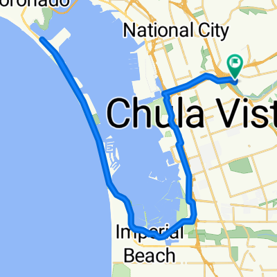
Lake Bay hill ride
A cycling route starting in Chula Vista, California, United States.
Overview
About this route
hilly ride bu very senic
- -:--
- Duration
- 56.1 km
- Distance
- 346 m
- Ascent
- 344 m
- Descent
- ---
- Avg. speed
- ---
- Max. altitude
Route quality
Waytypes & surfaces along the route
Waytypes
Quiet road
17.4 km
(31 %)
Road
9.5 km
(17 %)
Surfaces
Paved
47.1 km
(84 %)
Asphalt
42.1 km
(75 %)
Paved (undefined)
4.5 km
(8 %)
Continue with Bikemap
Use, edit, or download this cycling route
You would like to ride Lake Bay hill ride or customize it for your own trip? Here is what you can do with this Bikemap route:
Free features
- Save this route as favorite or in collections
- Copy & plan your own version of this route
- Sync your route with Garmin or Wahoo
Premium features
Free trial for 3 days, or one-time payment. More about Bikemap Premium.
- Navigate this route on iOS & Android
- Export a GPX / KML file of this route
- Create your custom printout (try it for free)
- Download this route for offline navigation
Discover more Premium features.
Get Bikemap PremiumFrom our community
Other popular routes starting in Chula Vista
 2872–2952 Plaza Bonita Rd, National City to 2872–2952 Plaza Bonita Rd, National City
- Distance
- 63.4 km
- Ascent
- 13 m
- Descent
- 26 m
- Location
- Chula Vista, California, United States
 Plaza Bonita Road 3330, National City to Plaza Bonita Road 3330, National City
- Distance
- 19.2 km
- Ascent
- 82 m
- Descent
- 81 m
- Location
- Chula Vista, California, United States
 Slow ride in Chula Vista
- Distance
- 39.5 km
- Ascent
- 19 m
- Descent
- 26 m
- Location
- Chula Vista, California, United States
 Route from 564 D St, Chula Vista
- Distance
- 11.2 km
- Ascent
- 3 m
- Descent
- 19 m
- Location
- Chula Vista, California, United States
 Recovered Route
- Distance
- 25.9 km
- Ascent
- 11 m
- Descent
- 21 m
- Location
- Chula Vista, California, United States
 Plaza Bonita Road 3374, National City to Crescent Drive 667, Chula Vista
- Distance
- 27.8 km
- Ascent
- 217 m
- Descent
- 143 m
- Location
- Chula Vista, California, United States
 Ring Rd, National City to Ring Rd, National City
- Distance
- 50.6 km
- Ascent
- 0 m
- Descent
- 10 m
- Location
- Chula Vista, California, United States
 3030 Plaza Bonita Rd, National City to 1825 Strand Way, Coronado
- Distance
- 25 km
- Ascent
- 82 m
- Descent
- 95 m
- Location
- Chula Vista, California, United States
Open it in the app